Tuesday, February 28th, 2012
An Antarctic lobby group, backed by major conservation groups and celebrities, is calling for a massive marine reserve in the Ross Sea as part of an even bigger reserve surrounding Antarctica. It would include a substantial proportion of...
Wednesday, February 15th, 2012
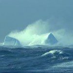
In his account of the Australasian Antarctic Expedition of 1911–14, Sir Douglas Mawson (1915) described his encounter with large icebergs, resembling ice walls, during the voyage south to Adélie Land in January 1912: 'a south‒south‒east was blowing...

Thursday, February 9th, 2012
Sea ice is an important contributor to global climate changes. Specifically, sea ice thickness helps to understand ocean circulation and heat transfer. The ability to capture more information about global sea ice thickness has advanced considerably and...
Thursday, January 26th, 2012
In his account of the Australasian Antarctic Expedition of 1911–14, Sir Douglas Mawson (1915) described his encounter with large icebergs, resembling ice walls, during the voyage south to Adélie Land in January 1912: 'a south‒south‒east was blowing...
Tuesday, December 20th, 2011
In his account of the Australasian Antarctic Expedition of 1911–14, Sir Douglas Mawson (1915) described his encounter with large icebergs, resembling ice walls, during the voyage south to Adélie Land in January 1912: 'a south‒south‒east was blowing...
Wednesday, November 9th, 2011
The city-based National Remote Sensing Centre will set up a remote sensing ground station in the continent of Antarctica. The ground station, that will be connected to the NRSC's station in Shadnagar on the city outskirts, will be...
Tuesday, August 9th, 2011
The calving of icebergs (where a huge chunk of ice breaks off from a glacier or ice shelf) from the Sulzberger Ice Shelf in Antarctica was linked to the tsunami, which originated with the magnitude 9.0 earthquake off the...