Asian Surveying & Mapping
Breaking News
Ecolab and ITE partners to harness water management knowledge for Singapore data center engineers
SINGAPORE, 29 APRIL 2024 – Nalco Water, an Ecolab...
NASA releases satellite photos of Dubai and Abu Dhabi before and after record flooding
NASA released photos of parts of Dubai and Abu...
Singapore releases 10-year Geospatial Master Plan
Singapore has launched its new Geospatial Master Plan (2024–33),...
Japan announces plans to launch upgraded observation satellites on new flagship rocket’s 3rd flight
TOKYO (AP) — Japan’s space agency announced Friday a...
Tesla China partners with Baidu for maps to clear FSD hurdle
Amidst Elon Musk’s unannounced trip to Beijing, China this...
ESA opens ideas factory to boost space innovation in Austria
A centre to innovate the design and manufacture of...
Japan’s space agency sets June 30 as third launch date for H3 rocket
The Japan Aerospace Exploration Agency (JAXA) announced Friday that...
S. Korea launches nanosatellite for Earth observation
SEOUL- A South Korean nanosatellite was launched into orbit...
Australian Space Agency funds development of aerospace-grade GNSS receiver
The Australian Space Agency has funded the development of...
Continuity risks for Australian EO data access
A new report details the widespread use of Earth...

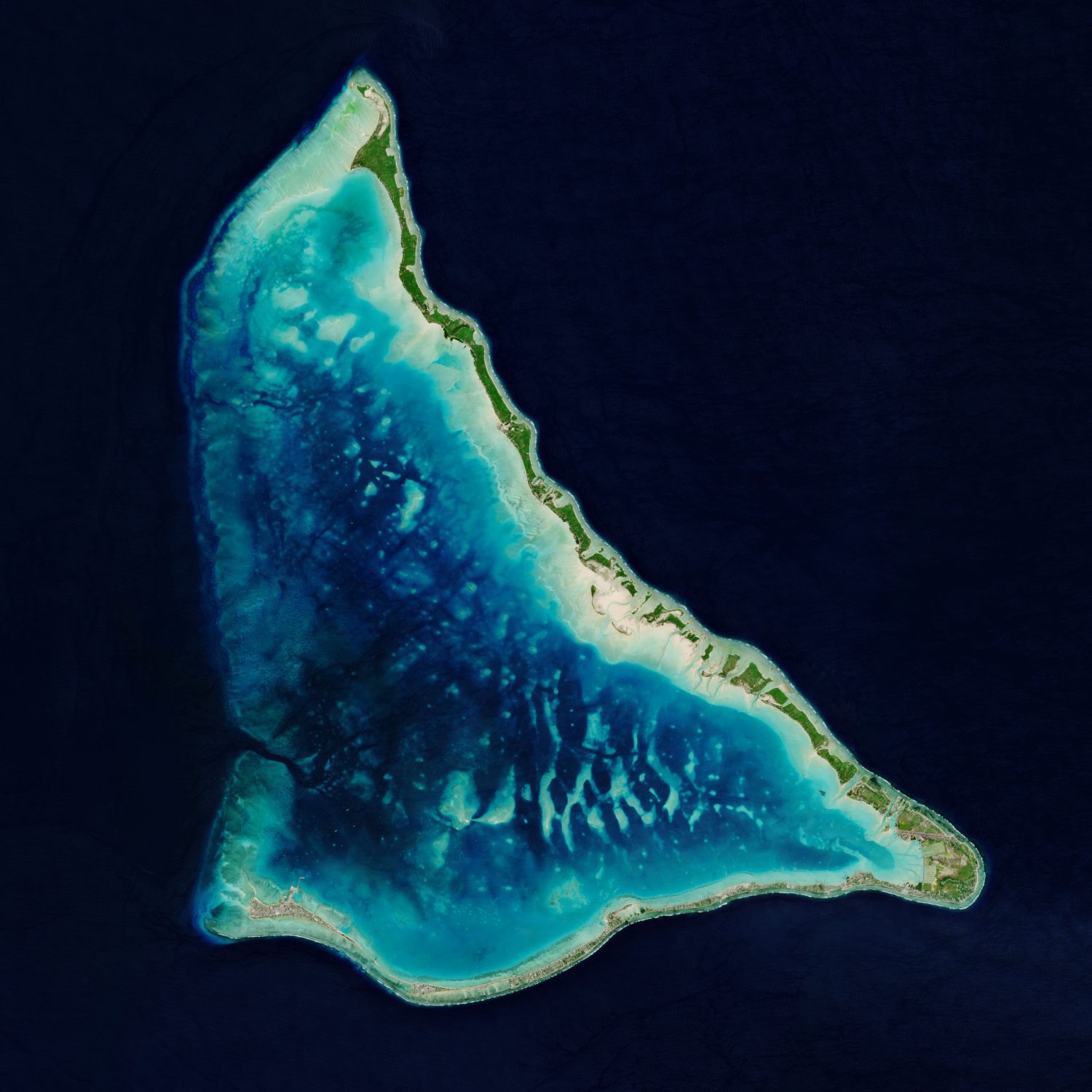
The Republic of Kiribati is an independent island nation consisting of some 33 atolls near the equator in the central Pacific. The islands are spread over approximately 3.5 million square kilometers of ocean, but with a total land area of only 800 square kilometers.

Tarawa Atoll, pictured here in a Copernicus Sentinel-2 image, lies approximately halfway between Hawaii and Australia. Tarawa consists of a large lagoon fringed by a V-shaped reef, around 35 kilometers long, and is made up of more than 30 islets. Tarawa, the site of a brutal World War II battle, is divided into North and South Tarawa.

South Tarawa is made up of a thin string of islets joined by causeways and is home to more than half of Kiribati’s 100,000 citizens. Bonriki International Airport serves as the main gateway to the country and can be seen in the bottom right of the image.

Kiribati is one of the lowest-lying nations in the world, with many of the country’s atolls and coral islands rising no higher than 2 meters above sea level, making them extremely vulnerable to sea-level rise. Kiribati has already seen growing damage from storms and flooding. In 1999, two of the nation’s unpopulated islets, Tebua Tarawa and Abanuea, disappeared underwater entirely.

Image Credit: Contains modified Copernicus Sentinel data (2020), processed by ESA.