Asian Surveying & Mapping
Breaking News
Ecolab and ITE partners to harness water management knowledge for Singapore data center engineers
SINGAPORE, 29 APRIL 2024 – Nalco Water, an Ecolab...
NASA releases satellite photos of Dubai and Abu Dhabi before and after record flooding
NASA released photos of parts of Dubai and Abu...
Singapore releases 10-year Geospatial Master Plan
Singapore has launched its new Geospatial Master Plan (2024–33),...
Japan announces plans to launch upgraded observation satellites on new flagship rocket’s 3rd flight
TOKYO (AP) — Japan’s space agency announced Friday a...
Tesla China partners with Baidu for maps to clear FSD hurdle
Amidst Elon Musk’s unannounced trip to Beijing, China this...
ESA opens ideas factory to boost space innovation in Austria
A centre to innovate the design and manufacture of...
Japan’s space agency sets June 30 as third launch date for H3 rocket
The Japan Aerospace Exploration Agency (JAXA) announced Friday that...
S. Korea launches nanosatellite for Earth observation
SEOUL- A South Korean nanosatellite was launched into orbit...
Australian Space Agency funds development of aerospace-grade GNSS receiver
The Australian Space Agency has funded the development of...
Continuity risks for Australian EO data access
A new report details the widespread use of Earth...

India’s 2019 monsoon season has been one of the most unusual in recent decades. From June to September 2019, India received the highest amount of monsoonal rain in 25 years of records. According to the India Meteorological Department, those rains are not expected to retreat until at least October 10, 2019, which would be the latest withdrawal of the monsoon in the country’s recorded history.

The monsoon usually accounts for around 70 percent of India’s annual rainfall, but the surplus this year has caused major hardship. According to local media, floods this year have displaced or injured at least 2.5 million people in 22 states and killed several thousand.

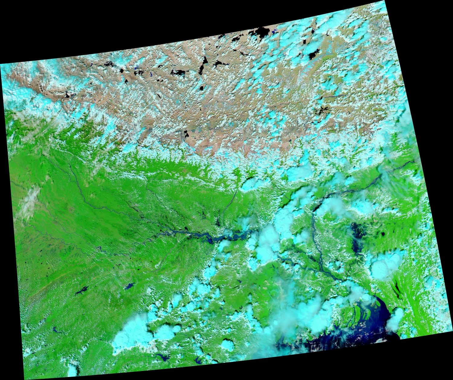
The most recently affected area is the state of Bihar in eastern India. In just a few days in late September, extreme rainfall covered many areas with knee-deep water. This image (acquired by the Moderate Resolution Imaging Spectroradiometer (MODIS) on NASA’s Aqua satellite) shows the flooding around the Ganges River in Bihar. 

Image Credit: NASA Earth Observatory images by Joshua Stevens, using MODIS data from NASA EOSDIS/LANCE and GIBS/Worldview.