Asian Surveying & Mapping
Breaking News
Ecolab and ITE partners to harness water management knowledge for Singapore data center engineers
SINGAPORE, 29 APRIL 2024 – Nalco Water, an Ecolab...
NASA releases satellite photos of Dubai and Abu Dhabi before and after record flooding
NASA released photos of parts of Dubai and Abu...
Singapore releases 10-year Geospatial Master Plan
Singapore has launched its new Geospatial Master Plan (2024–33),...
Japan announces plans to launch upgraded observation satellites on new flagship rocket’s 3rd flight
TOKYO (AP) — Japan’s space agency announced Friday a...
Tesla China partners with Baidu for maps to clear FSD hurdle
Amidst Elon Musk’s unannounced trip to Beijing, China this...
ESA opens ideas factory to boost space innovation in Austria
A centre to innovate the design and manufacture of...
Japan’s space agency sets June 30 as third launch date for H3 rocket
The Japan Aerospace Exploration Agency (JAXA) announced Friday that...
S. Korea launches nanosatellite for Earth observation
SEOUL- A South Korean nanosatellite was launched into orbit...
Australian Space Agency funds development of aerospace-grade GNSS receiver
The Australian Space Agency has funded the development of...
Continuity risks for Australian EO data access
A new report details the widespread use of Earth...
  • Jul 30, 2019
  • Comments Off on Researchers from University of Adelaide Win Global Pose Estimation Challenge
  • Feature
  • 809 Views

The team of researchers from the University of Adelaide’s Australian Institute for Machine Learning (AILM) defeated 47 other universities and space technology companies at the international space competition hosted by the European Space Agency.

The South Australian team—including Associate Professor Tat-Jun Chin, Dr. Bo Chen and Dr. Alvaro Parra Bustos—won the challenge to determine the most accurate orientation of an object in space by using machine learning and 3D vision algorithms.

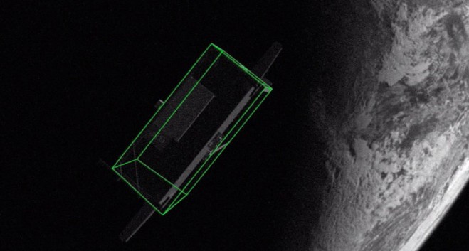
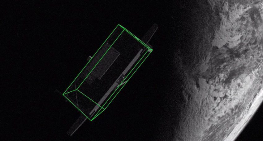
Teams were given individual high-fidelity images of the Tango spacecraft from the 2016 PRISMA mission and were required to determine the orientation of the craft in relation to the observer from close rendezvous.

The goal of the challenge was to estimate the pose—the relative position and attitude—of a known spacecraft in order to help future space missions.

Knowing the exact pose enables the development of debris-removal technologies, refurbishment of expensive space assets, and the development of space depots to facilitate travel toward distant destinations.