Asian Surveying & Mapping
Breaking News
Ecolab and ITE partners to harness water management knowledge for Singapore data center engineers
SINGAPORE, 29 APRIL 2024 – Nalco Water, an Ecolab...
NASA releases satellite photos of Dubai and Abu Dhabi before and after record flooding
NASA released photos of parts of Dubai and Abu...
Singapore releases 10-year Geospatial Master Plan
Singapore has launched its new Geospatial Master Plan (2024–33),...
Japan announces plans to launch upgraded observation satellites on new flagship rocket’s 3rd flight
TOKYO (AP) — Japan’s space agency announced Friday a...
Tesla China partners with Baidu for maps to clear FSD hurdle
Amidst Elon Musk’s unannounced trip to Beijing, China this...
ESA opens ideas factory to boost space innovation in Austria
A centre to innovate the design and manufacture of...
Japan’s space agency sets June 30 as third launch date for H3 rocket
The Japan Aerospace Exploration Agency (JAXA) announced Friday that...
S. Korea launches nanosatellite for Earth observation
SEOUL- A South Korean nanosatellite was launched into orbit...
Australian Space Agency funds development of aerospace-grade GNSS receiver
The Australian Space Agency has funded the development of...
Continuity risks for Australian EO data access
A new report details the widespread use of Earth...

April 30th, 2019
Visiting a Young Island

image

On Oct. 8, 2018, Dan Slayback of NASA’s Goddard Space Flight Center in Greenbelt, Md., joined scientists and students with the Sea Education Association’s SEA Semester South Pacific cruise to visit a three-year-old island he’d only seen from space.

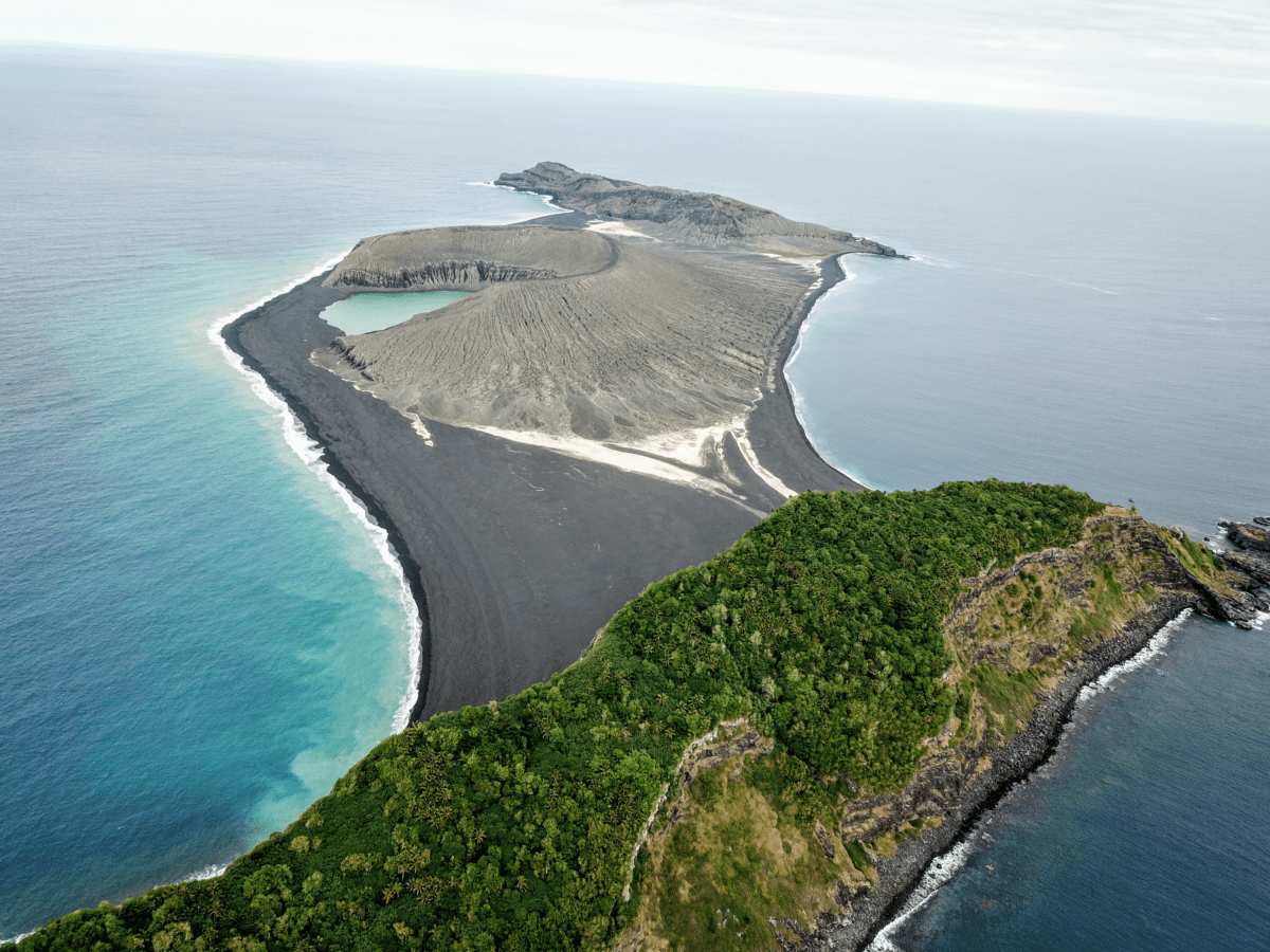
“There’s no map of the new land,” Slayback said. It erupted from the rim of an underwater caldera in early 2015, nestled between two older islands. The new Tongan island is one of only three that has erupted in the last 150 years that have survived the ocean’s eroding waves longer than a few months.

The three-year-old volcanic island (center) as seen from the SEA drone. (Credit: Sea Education Association/SEA Semester)

Slayback and his colleagues Jim Garvin at Goddard and Vicki Ferrini at Columbia University have been watching it from satellites since its birth, trying to make a 3D model of its shape and volume as it changes over time to understand how much material has been eroded and what it is made of that makes it partially resistant to erosion. But while high-resolution satellite observations are revolutionary for studying remote regions, they can only tell you so much without actually visiting the place on the ground.