Asian Surveying & Mapping
Breaking News
Ecolab and ITE partners to harness water management knowledge for Singapore data center engineers
SINGAPORE, 29 APRIL 2024 – Nalco Water, an Ecolab...
NASA releases satellite photos of Dubai and Abu Dhabi before and after record flooding
NASA released photos of parts of Dubai and Abu...
Singapore releases 10-year Geospatial Master Plan
Singapore has launched its new Geospatial Master Plan (2024–33),...
Japan announces plans to launch upgraded observation satellites on new flagship rocket’s 3rd flight
TOKYO (AP) — Japan’s space agency announced Friday a...
Tesla China partners with Baidu for maps to clear FSD hurdle
Amidst Elon Musk’s unannounced trip to Beijing, China this...
ESA opens ideas factory to boost space innovation in Austria
A centre to innovate the design and manufacture of...
Japan’s space agency sets June 30 as third launch date for H3 rocket
The Japan Aerospace Exploration Agency (JAXA) announced Friday that...
S. Korea launches nanosatellite for Earth observation
SEOUL- A South Korean nanosatellite was launched into orbit...
Australian Space Agency funds development of aerospace-grade GNSS receiver
The Australian Space Agency has funded the development of...
Continuity risks for Australian EO data access
A new report details the widespread use of Earth...
EarthEngine

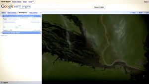
The tools were made available to rainforest nations in advance of this week’s climate talks as both a means of assessing carbon in their forests and as a testbed for system development. Earth Engine is not only a core platform for hosting imagery and other geospatial data, it is also an analysis processing framework with an Earth Engine API for scientists to write their own code to customize the platform for their area of interest. Google is also providing 20 million CPU hours for free to scientists and developing countries to take advantage of the new analytical tool.

Earth Engine has been a collaborative effort that has included contributions from Greg Asner of the Carnegie Institution for Science, Carlos Souza of Imazon and Matt Hansen of the Geographic Information Science Center at South Dakota State University.

It is hoped that this year’s talks will result in an agreement on the U.N. initiative known as Reducing Emissions from Deforestation and Forest Degradation in Developing Countries (REDD), and this tool will act as a means to monitor and enforce such an agreement, tracking environmental change and deforestation rates in real time.

View an explanatory video for more details or visit the Google Earth Engine website.