Asian Surveying & Mapping
Breaking News
Ecolab and ITE partners to harness water management knowledge for Singapore data center engineers
SINGAPORE, 29 APRIL 2024 – Nalco Water, an Ecolab...
NASA releases satellite photos of Dubai and Abu Dhabi before and after record flooding
NASA released photos of parts of Dubai and Abu...
Singapore releases 10-year Geospatial Master Plan
Singapore has launched its new Geospatial Master Plan (2024–33),...
Japan announces plans to launch upgraded observation satellites on new flagship rocket’s 3rd flight
TOKYO (AP) — Japan’s space agency announced Friday a...
Tesla China partners with Baidu for maps to clear FSD hurdle
Amidst Elon Musk’s unannounced trip to Beijing, China this...
ESA opens ideas factory to boost space innovation in Austria
A centre to innovate the design and manufacture of...
Japan’s space agency sets June 30 as third launch date for H3 rocket
The Japan Aerospace Exploration Agency (JAXA) announced Friday that...
S. Korea launches nanosatellite for Earth observation
SEOUL- A South Korean nanosatellite was launched into orbit...
Australian Space Agency funds development of aerospace-grade GNSS receiver
The Australian Space Agency has funded the development of...
Continuity risks for Australian EO data access
A new report details the widespread use of Earth...
  • Feb 20, 2018
  • Comments Off on Satellite Derived Bathymetry Plays Key Role in Aquaculture Siting Project
  • Feature
  • 1664 Views

BMT uses Satellite Derived Bathymetry from TCarta as a critical dataset in the selection of new fish-farming sites in the Arabian Gulf. BMT is performing the site selection work on behalf of Environment Agency – Abu Dhabi (EAD).

“Aquaculture development is emerging as a major market for highly accurate bathymetric data products,” said David Critchley, CEO of TCarta, a global provider of marine and terrestrial geospatial solutions based in Bristol, United Kingdom.

TCarta extracts accurate seafloor depth measurements as well as seabed surface classifications from high-resolution satellite imagery. The resulting bathymetric data has an accuracy of two meters to a depth of 20 meters.

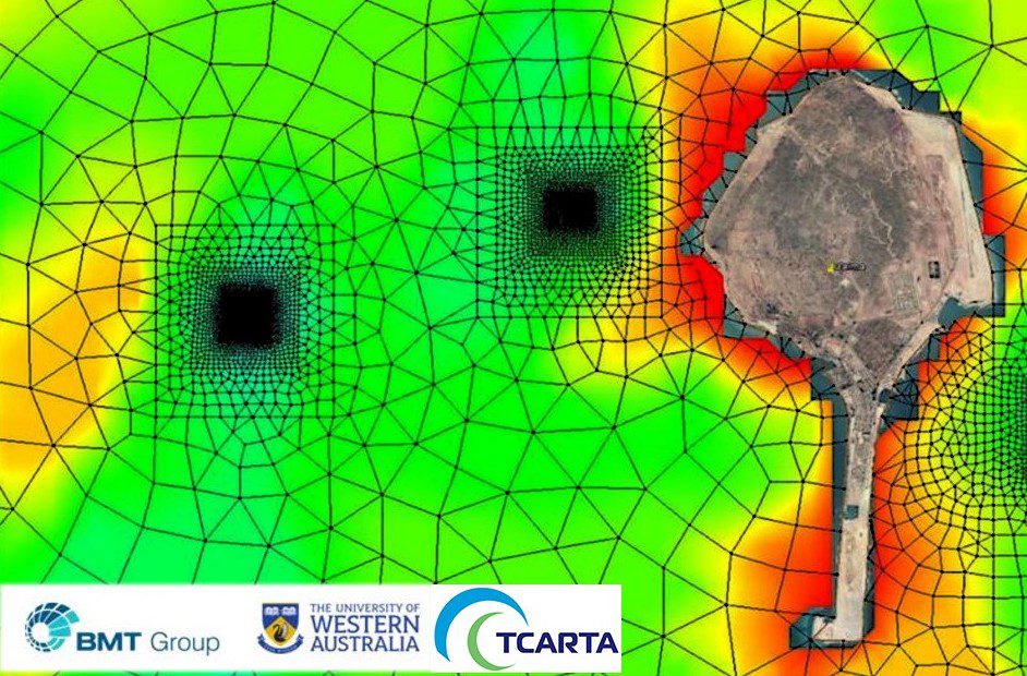
As a primary input for the modeling phase of the project, BMT obtained five-meter-resolution Satellite Derived Bathymetry (SDB) products from TCarta for the waters around Delma. BMT also used TCarta Marine Habitat Maps, which differentiate the surface compositions of the seafloor around the island in waters to approximately 10 meters deep.