Asian Surveying & Mapping
Breaking News
Ecolab and ITE partners to harness water management knowledge for Singapore data center engineers
SINGAPORE, 29 APRIL 2024 – Nalco Water, an Ecolab...
NASA releases satellite photos of Dubai and Abu Dhabi before and after record flooding
NASA released photos of parts of Dubai and Abu...
Singapore releases 10-year Geospatial Master Plan
Singapore has launched its new Geospatial Master Plan (2024–33),...
Japan announces plans to launch upgraded observation satellites on new flagship rocket’s 3rd flight
TOKYO (AP) — Japan’s space agency announced Friday a...
Tesla China partners with Baidu for maps to clear FSD hurdle
Amidst Elon Musk’s unannounced trip to Beijing, China this...
ESA opens ideas factory to boost space innovation in Austria
A centre to innovate the design and manufacture of...
Japan’s space agency sets June 30 as third launch date for H3 rocket
The Japan Aerospace Exploration Agency (JAXA) announced Friday that...
S. Korea launches nanosatellite for Earth observation
SEOUL- A South Korean nanosatellite was launched into orbit...
Australian Space Agency funds development of aerospace-grade GNSS receiver
The Australian Space Agency has funded the development of...
Continuity risks for Australian EO data access
A new report details the widespread use of Earth...
Imagery from Diwata-1 are expected to make it easier to identify areas affected by disasters such as floods and fires.

Imagery from Diwata-1 are expected to make it easier to identify areas affected by disasters such as floods and fires.

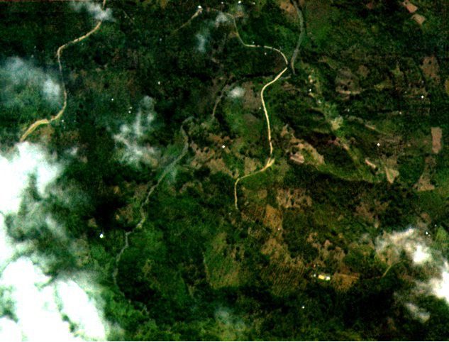
Diwata-1, the Philippines’ first microsatellite, collected and returned test images of some portions of Dumingag town in Zamboanga del Sur, a mountainous area in Mindanao, according to an attached agency of the country’s Department of Science and Technology. The images were taken by the high-precision telescope (HPT), one of four cameras onboard Diwata-1.

The Advanced Science and Technology Institute (ASTI) and the University of the Philippines Diliman noted that the images have a ground resolution of three meters at nadir (lowest point), which is the highest resolution attained by a microsatellite in the 50-kilogram class.

ASTI and UPD are coordinating with Japan’s Hokkaido and Tohoku Universities, which currently handle Diwata-1’s operation.

Click here for more information.