
Saturday, December 18th, 2010
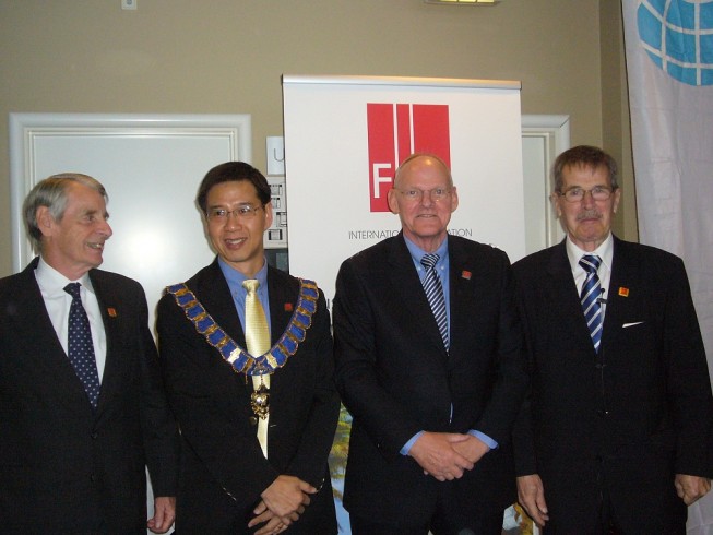
I am deeply humbled and honoured to wear this chain of office as I stand before all of you today. The immensity and weight of this responsibility are not loss on me. It is a responsibility and stewardship that...

Saturday, December 18th, 2010
The formal Handover Ceremony between the current and incoming FIG Councils and Commission chairs took place in Copenhagen 26 November 2010. At the Handover Ceremony President Stig Enemark gave the President's Chain of Office to the incoming President CheeHai...

Friday, December 17th, 2010
Last week three GLONASS satellites were launched from Baikonur, Russia and failed to achieve orbit. A quick review of the international media showed a wide variation in response. Some were downright negative, seeing the failure as the...

Friday, December 10th, 2010
The United Nations Climate Change Conference in Cancun, Mexico will wrap up this weekend. This round of debate and discussions follows on the events of Copenhagen last year, and so far has not brought any major agreements...
Saturday, December 4th, 2010
The State Committee for Land & and Cartography of Azerbaijan has conducted work on the opening of a new riverbed of the Arax River. Committee’s head Garib Mammadov says that in this connection it was carried out...

Friday, December 3rd, 2010
Crowdsourcing involves the data capture and collection efforts of many people who each contribute a smaller piece to a larger geospatial data and geoinformation puzzle. OpenStreetMap is perhaps the most well-known crowdsourcing project internationally, and serves to...
Friday, December 3rd, 2010
Blue Marble Geographics (www.bluemarblegeo.com) is pleased to announce a functional enhancement within the Geographic Calculator v7.5, the addition of an enhanced area calculation tool. Whether it is coordinate, vector, or raster data types, the Blue Marble Desktop...

Thursday, November 4th, 2010
Land surveys provide the means to initiate administrative actions that support growth and development. Different countries approach the construction of national land datasets in different ways. In Korea, a national land survey was initiated and it included...

Friday, October 29th, 2010
Over the past several years, City of Shanghai leaders have been focusing their efforts on creating a greener and more sustainable city. Being awarded the World Expo 2010 event was even...

Friday, September 10th, 2010
The ownership of equipment has been easy to determine. And the same can be said for spatial information as well. Even employees working on problems and developing spatial solutions are paid...
