
Thursday, September 29th, 2011
Tunnelling has gone high-tech. Integrating survey data, monitoring information, data management and collaborative interaction, tunnelling is a shared effort and technologies are increasingly being integrated toward common web-based management systems. As tunnels proceed, machinery wear, alignment, shift...
Wednesday, September 28th, 2011
A South African company is pioneering the latest laser scanning technology with plans to mount high speed scanners on a variety of mobile platforms including a gyrocopter, 4x4’s and even a golf cart. Supplied by 3D Laser...
Wednesday, September 28th, 2011
Trimble introduced today a new version of its terrestrial mobile mapping office software—Trimble Trident Analyst 4.7. The software is designed to effectively manage and interpret high-resolution digital images and large point clouds, and automatically extract features from...
Friday, September 23rd, 2011
Woodside has commissioned Fugro to undertake a detailed seabed mapping program, extending offshore from the proposed Central Processing Facility, that will provide high quality data to assist with the engineering process for the proposed subsea pipelines and other infrastructure...
Wednesday, September 21st, 2011
Tekla and GRAPHISOFT's long-term cooperation continues, as the Tekla BIMsight software application for building information model-based construction project collaboration becomes available on GRAPHISOFT’s MyArchiCAD.com. For years, GRAPHISOFT and Tekla Corporation have dedicated themselves to offering the best software...

Thursday, September 15th, 2011
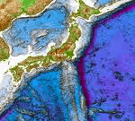
Earlier this week, China announced that it will increase it's level of seabed mapping and surveying. These operations aim to describe seabed geology, water depths and the location of features and objects. Surveying of the waters and...
Thursday, September 15th, 2011
China will accelerate its pace of mapping the deep seabed, Zhang Jixian, president of the Chinese Academy of Surveying and Mapping, told China Daily in an exclusive interview. "In the near future, China's surveying and mapping science will...
Thursday, September 15th, 2011
Sokkia Corporation has released the NET-AX series of automated total stations in North and South America. The series includes NET05AX for 0.5” angle accuracy and NET1AX for 1” angle accuracy. “The new series offers the highest level of...
Monday, September 5th, 2011
In accordance with the unified arrangements of the CPC Central Committee Organization Department, the State Bureau of Surveying and Mapping Geographic Information hosts digital city construction special class 2 to 7 September in Chengdu, Sichuan Wenjiang held. State...
Monday, September 5th, 2011
Saudi Arabia’s petrochemicals industry is about to get a massive boost, with a new $20bn plant in the works and extensive state spending on infrastructure set to further improve the nation’s logistics backbone. Before the full benefits...
