
Wednesday, March 21st, 2012
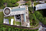
For the first time Singaporean authorities have given permission for a photogrammetric UAV mapping/modeling flight over an important area of the city. In the context of the SEC-FCL (Future Cities Laboratory) project a pilot study is conducted...
Friday, March 16th, 2012
The Singapore Satellite Positioning Reference Network, SiReNT is a nation-wide reference network developed to support real-time high precision land surveying and other positioning applications. An initiative by Singapore Land Authority (SLA), SiReNT provides Differential GPS (DGPS) services...
Thursday, November 24th, 2011
AceCad Software announced a distribution agreement with Singapore-based company IOCS, a niche engineering software reseller in the region. The partnership agreement signed between the two companies entitles IOCS to promote and distribute AceCad Software’s leading StruCad platform products and services...
Sunday, October 9th, 2011
Property rights have always been shown in 2D with the surface parcel being the fundamental representation of ownership. Complex 3D situations, interlocking properties, multi-levelled train station, underground rock caverns are all immediate but unresolved challenges for us...

Thursday, September 8th, 2011
Singapore's Urban Redevelopment Authority (URA) has won the prestigious Exemplary Systems in Government (ESIG) award from the Urban and Regional Information Systems Association (URISA). The URA Digital 3D Urban Model System garnered praise because it was built...
Monday, August 29th, 2011
DHL Express Singapore has put its foot on the green accelerator, with a new pilot initiative to improve fuel efficiency by tracking the driving habits of its delivery staff. The logistics company's Vehicle Energy Reduction Program (VERP) trial,...
Tuesday, June 15th, 2010