Thursday, July 7th, 2011
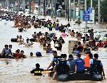
Environment and Natural Resources Secretary Ramon J. P. Paje today urged local officials to familiarize themselves with the geohazard maps, and implement the necessary measures to reduce the impact of natural disasters on people’s lives and properties. Paje...

Wednesday, April 20th, 2011
Philippine President Benigno Aquino has set asside P1 billion ($23.25 million) to create a 3D map of the entire country. The detailed map is part of an effort to guard and plan against disasters, with 66 provinces...
Wednesday, March 30th, 2011
The National Economic Development Authority of the Philippines has just recently launched its Regional Geographic Information Systems Centre in the Caraga Region which aims to encourage sharing of spatial information among government, private, and academic institutions in...
Wednesday, March 16th, 2011
According to NEDA-Caraga regional director Carmencita S. Cochingco, as the socioeconomic planning agency of the region and the secretariat of the Regional Development Council (RDC), their office will spearhead the institutionalization of a geographic information system (GIS)...
Wednesday, February 23rd, 2011
The National Mapping and Resource Information Authority (NAMRIA), an attached agency of the Department of Environment and Natural Resources (DENR) is soon to undertake a mapping project which can provide up-to-date geospatial information significant for the country’s...
Saturday, January 15th, 2011
The province of Cebu and the Cebu chapters of the League of Municipalities of the Philippines (LMP) and the Vice Mayors League of the Philippines (VLMP) have partnered with the United Nations International Strategy for Disaster Reduction...