Asian Surveying & Mapping
Breaking News
South Korea is converting an abandoned coal mine into a moon exploration testing ground
South Korea is transforming abandoned coal mines into testing...
ISRO to Launch Chandrayaan-5 With Japan, Plans Space Station
Dr. V. Narayanan, Chairman of the Indian Space Research...
Russia and China are threatening SpaceX’s Starlink satellite constellation, new report finds
SpaceX's Starlink satellite constellation is facing threats from Russia...
China and Pakistan agree to fly 1st foreign astronaut to Chinese space station
For the first time, the Chinese space program will train...
ISRO’s “Space on Wheels” offers a peek into Indian Space Programme to students in Karimnagar
The Indian Space Research Organisation (ISRO)’s “Space on Wheels”...
Geospatial led solutions build the foundations for better decision-making
Geo Connect Asia 2025 paves the way for turning...
GEOSA, Singapore Land Authority Launch Achievements of Joint Geospatial System Project
Riyadh, SPA -- The General Authority for Survey and...
Building in Bangkok collapses as powerful earthquake hits southeast Asia
One person has died and 50 were injured in...
Bellatrix Aerospace Partners with Astroscale Japan for Space Debris Removal
Bellatrix Aerospace, a Bengaluru-based space mobility company, has joined...
NSTC announces Pingtung site as Taiwan’s space mission launch center
Taipei, March 26 (CNA) Taiwan's National Science and Technology...

Mapping

Friday, December 3rd, 2010

ViewRanger is Now Available for the iPhone

Online Open Street and Cycle mapping - use free open mapping, giving worldwide coverage. Unlike premium mapping, these maps are downloaded automatically as you need them. They are then cached on the iPhone or iPad, so only...
Thursday, November 25th, 2010

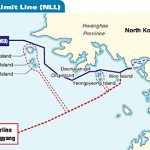
Value of a Map: North Korea – South Korea

This past week saw North Korea launch live ammunition into South Korea. The event has raised tensions in the region. While the original border between these two countries was mapped when the Armistice was signed in 1953,...

Friday, November 19th, 2010

Mt. Merapi – Challenging Spatial Information Technology

Mt. Merapi began erupting October 26 and has pushed volcanic ash into the atmosphere continuously at an alarming rate. This ash has already claimed 200 lives. Furthermore, it has had damaging consequences for not only the native...

Thursday, November 4th, 2010

The Group on Earth Observation Convenes This Week in China

The Group on Earth Observations (GEO) convenes in China this week to discuss the creation and coordination of the planetary system of earth observation. The Seventh Plenary Session from Nov. 3-5 in Beijing marks the fifth year...

Thursday, November 4th, 2010

Laser Mapping Helps Predict Avalanches in the Himalayas

The Defence Research and Development Organization (DRDO), one of Asia's largest research and development organizations, has teamed with Elcome Technologies in India to deploy the Snow and Avalanche Study Establishment (SASE). SASE is deploying the SiteMonitor laser...

Thursday, August 26th, 2010

Mapping the Earth’s Changes Over Time

Without time there is no change. Over longer periods of time we may expect more changes, but very significant changes can arise in short durations. Heavy rainfall brings floods, an earthquake...

Friday, July 16th, 2010

Transportation Through Surveying and Mapping

Advances in surveying and mapping technologies are quickly adopted in the transportation sector. While many people are interested in actual traffic movement, the construction of roads, bridges, rail, airports and other...

Thursday, June 10th, 2010

Resource Mapping of East China Sea Remains Tense

As countries have exhausted their terrestrial natural resource reserves, they are turning to sea-bed resources. Perhaps nowhere else in the world is this practice as politically charged as the East China Sea. Particularly...

Wednesday, June 9th, 2010

Mapping the Pacific Ocean

The Pacific Ocean plays a dominate role to the many countries and people of Asia. This contribution can be measured in many ways, from food to resources, transport and weather moderation. But how much do we...

Tuesday, May 11th, 2010

About This Site

    Asian Surveying and Mapping became part of Vector1 Media in January of 2010. Vector1 Media has been created by experienced and seasoned editorial staff.   Vector1 Media includes Sensors & Systems, Informed Infrastructure, and Asian...

Page 64 of 66 1 59 60 61 62 63 64 65 66