
Thursday, March 3rd, 2011
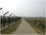
There is talk that a long-awaited land swap between India and Bangladesh may take place when India's prime minister Manmohan Singh visits Bangladesh later this year. The land along its northern border has been in dispute since...
Saturday, February 26th, 2011
After 16 successful launches of its workhorse rocket Polar Satellite Launch Vehicle (PSLV) in the last 17 years, the Indian space agency is now testing a key component to re-qualify its on-flight performance parameters to avoid any...
Monday, February 21st, 2011
The government has accorded infrastructure development the highest priority and allocated for it Rs.20 lakh crore in the Eleventh Five Year Plan, which ends March 2012. In the subsequent five-year plan, the government plans to double the...
Sunday, February 20th, 2011
With a view to provide better service to consumers and fix the faults in electricity lines quickly, the Hubli Electricity Supply Company (Hescom) has taken measures to cover all low- and high-tension wires under Geographical Information System...
Thursday, February 17th, 2011
The scenic Kerala backwaters can now boast of an engineering marvel — the longest rail bridge in the country at 4.62km. The bridge is part of a 8.6-km railway link connecting Idapalli to Vallarpadam in Kochi, where...
Wednesday, February 9th, 2011
The Geological Survey of India brought out a Publication entitled Seismotectonic Atlas of India and its Environs, authored by S. Dasgupta, P. Pande, D. Ganguly, Z. Iqbal, K. Sanyal, N.V. Venkataraman, S. Dasgupta, A. Roy, L.K. Das,...
Saturday, January 29th, 2011
Web-based GIS (Geographic Information System) application being developed for Gobichettipalayam Municipality in Erode district is likely to be made available to the public in April this year. The application will be utilised in urban planning and civic services,...
Thursday, January 20th, 2011
Offering space and logistical support for setting up of country’s first Geospatial Technology Park, Gujarat Chief Minister Narendra Modi today invited the world leaders in the sector ‘to be part of the growth story of Gujarat.’
...Monday, January 17th, 2011
We know that groundwater management is critical to India's water, food and livelihood security. Groundwater supports more than 55% of our irrigation requirements, 85% of domestic requirements in rural areas and over 50% of requirements in urban...