Tuesday, December 13th, 2011
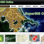
SuperGeo announces that SuperGIS Online Website is officially launched, making the GIS data and services accessible through the Internet.
Saturday, December 10th, 2011
Kanpur Nagar Nigam (KNN) has won an award for creating unique geographical information system (GIS), designed to locate the houses in the city. Municipal commissioner R Vikram Singh praised the efforts of the staff and emphasized to maintain standards in...
Thursday, December 8th, 2011
The uDig Community is pleased to announce the release of uDig 1.3.0. This release is made in conjunction with GeoTools 8.0-M4. Thanks to Andrea Amie and Gabriel Roldan for support, encouragement and timely bug fixes. This point release...
Thursday, December 8th, 2011
GIS data is being implemented in hundreds of ways by dozens of industries. Having the necessary data inputs is fundamental to performing tasks successfully and accurately. As most GIS users can attest to, obtaining geographic data in foreign...
Tuesday, December 6th, 2011
SuperGeo Technologies is pleased to announce that the University of Sharjah in United Arab Emirate (UAE) utilized SuperGIS Desktop 3 for the research and teaching of geospatial information. Founded in 1997, The University of Sharjah is a semi-governmental...
Tuesday, December 6th, 2011
SuperGIS Server, developed by SuperGeo, has been successfully applied to “Yilan Pollution Control GIS.” To effectively manage and control the pollution data and distribution in Yilan, Department of Environmental Protection Yilan adopts SuperGIS Server to build “Yilan Pollution...
Saturday, December 3rd, 2011
Designed for the Esri Flex Viewer 2.4, the Building Navigator widget allows users to click on a building footprint and drill down inside the building to view floors, spaces, and other data layers.
Friday, December 2nd, 2011
To provide with a map service web for citizens to query public health information, the Public Health Bureau of Miaoli County Government adopts SuperWebGIS to establish the “Miaoli Health Resource Web.” The web mainly provides three types...

Friday, December 2nd, 2011
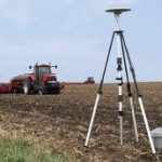
Agricultural food production is linked closely to geospatial technologies. From an agronomic perspective, variable rate (VR) approaches are about much more than nitrogen fertilizer applications alone. Plants depend upon several macro-nutrients and micro-nutrients as well as other...