
Friday, January 27th, 2012
Intergraph and ERDAS are two well known brands in the geospatial industry. Recently Hexagon AB purchased Intergraph for $2.1B USD, effectively bringing GeoMedia GIS software into the wider Hexagon domain - filling a large hole across the...
Wednesday, January 25th, 2012
The first of a number of national capacity development initiatives to be implemented in South East Asia by UNOSAT took place in Vietnam in December 2011. The initiative is part of the regional cooperation arrangements supported by...
Tuesday, January 17th, 2012
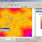
SuperGeo is going to release SuperGIS Spatial Analyst 3, which contains a number of spatial modeling and analysis algorithms and provides friendly user interface to help uses complete complicated spatial analysis tasks. Spatial analyst 3.0 mainly offers integration...
Wednesday, January 11th, 2012
Founded in 1988 and located in Dubai, UAE, Zayed University is established with the mission of providing the quality educational services and researches. The university comprises the collages of Arts, Sciences, Business, Communication and Media Sciences, Education, and Information Technology,...
Thursday, January 5th, 2012
To establish a service platform within a single intranet and effectively manage and integrate various types of data, Asia Pacific Telecom adopts SuperGIS Server as the core of the GIS platform. The enterprise GIS management platform allows...
Thursday, January 5th, 2012
SuperGeo Technologies, the leading global provider of complete GIS software and solutions, announced that the Forest Utilization Monitoring Center of Central Region, Indonesia (Balai BP2HP Wilayah XVIII Manokwari) purchased SuperGIS Desktop 3 from the local reseller, Datascrip....

Wednesday, January 4th, 2012
Higher commodity prices are resulting in higher bottom lines for many agricultural producers today. Productive agricultural land is no longer readily available, and a growing global population increasingly depends upon technological innovation to meet consumer needs. As...
Sunday, January 1st, 2012
Geo Tactical Solutions (GTS) is in the final stages of development for its new photo mapping and management software—PhotoGIS. PhotoGIS, planned to be released in early first quarter 2012, will allow users to easily map, organize, export...
Thursday, December 29th, 2011
SuperGeo Technologies announced that Municipality of Recanati in Italy selected SuperGIS Server 3 Value Edition to integrate and distribute large spatial data to multi client users. SuperGIS Server 3 is designed to create, manage, and share various...

Wednesday, December 21st, 2011
SuperGeo Technologies introduces SuperGIS Spatial Analyst 3, the spatial processing tool working with SuperGIS Desktop 3.1 to complete advanced spatial analyses and tasks. Designed for deriving information from geo-applications, the newly developed SuperGIS Spatial...