Tuesday, February 28th, 2012
All canals in HCM City are heavily polluted by domestic and industrial waste water, according to a newly issued report from the city's Department of Natural Resources and Environment. Testing of environmental criteria for suspended substances, BOD (biodiversity...
Monday, December 26th, 2011
Almost a year after the amended Coastal Regulation Zone (CRZ) notification was introduced by the Union Government’s Ministry of Environment and Forest, the Brihanmumbai Municipal Corporation (BMC) on Wednesday approved the proposal to appoint an organisation to...
Sunday, December 25th, 2011
Consider this: If humans had been able to go into orbit around the Earth 100 years ago, they could have seen the light from 16 concentrations of a million or more people. Today, as the crews of...
Tuesday, December 6th, 2011
China's investment overseas is increasingly important to the United States and the international community. The China Global Investment Trackercreated by The Heritage Foundation is the only publicly available, comprehensive dataset of large Chinese investments and contracts worldwide beyond...
Monday, December 5th, 2011
Organised together with the Department of Environment and Natural Resources (DENR) of the Philippines and with assistance from the Deutsche Gesellschaft für Internationale Zusammenarbeit (GIZ) GmbH, the workshop provided a forum for experts involved in ICI projects...
Monday, September 12th, 2011
Christine Acosta is a young engineer who detects leaks for Maynilad Water Services, Inc. to solve the mysterious cases of water losses in Metro Manila. In this interview, Christine talks about her job of finding missing water;...

Thursday, August 11th, 2011
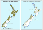
The government of New Zealand has announced a research programme today to use satellite imagery and geospatial mapping to map forests, pastures, rivers and cities across the country. The four-year Land Cover Research Programme was launched with...
Wednesday, June 15th, 2011
An eco-park, developed by Department of Environment and Remote Sensing (DERS) as a potential tourist attraction, was thrown open to visitors in Ganderbal district, an official spokesman said today. Spread over an area of over two acres of...
Wednesday, June 8th, 2011
The Democrat Party is seen as having an edge over Pheu Thai in terms of megaproject policies that are more realistic and potentially less harmful to the environment. However, the country's oldest party should create more variety...