
Tuesday, April 11th, 2017
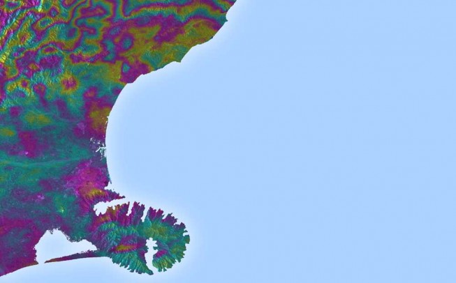
Satellite radar scans of the 7.8-magnitude Nov. 14, 2016, earthquake in New Zealand are changing the way scientists think about earthquake hazards in regions where Earth’s tectonic plates meet. The quake struck near the town of Kaikoura...
Wednesday, December 7th, 2016
Fugro’s LADS technology is being deployed in New Zealand to assist in relief efforts following the damaging 7.9 magnitude earthquake near Christchurch on 14th November 2016. At the request of the New Zealand Government, the Royal Australian...
Monday, April 18th, 2016
Japan is by no means new to earthquakes. With a history of terrifying natural events, it stands out as one of the most disaster-prone and disruptive geographic regions on the planet. Some of the most catastrophic and...

Thursday, August 13th, 2015
Crowdsourcing has added a new dimension to Nepal’s disaster response capability following the massive earthquake that struck this Himalayan country on 25 April, killing more than 8,000 people, injuring thousands and leaving tens of thousands displaced. Government...
Sunday, July 5th, 2015
China’s air force dispatched a drone to the site of an earthquake in the far-western region of Xinjiang on Friday to help in monitoring work, the first time it has used an unmanned aircraft for such a...
Sunday, March 4th, 2012
In March 2011, Japan was struck by a devastating earthquake, the fourth largest ever recorded in the world, which claimed more than 16,000 lives and devastated the country’s infrastructure, supply chains and exacerbated on-going economic issues. The...
Sunday, December 25th, 2011
Japanese mobile carrier KDDI has announced that it will establish a data center in Sendai, one of the areas hit the hardest by the earthquake and tsunami this past March. The center will be for managing mobile customer data, and will...
Wednesday, December 14th, 2011
The historic 9.0 earthquake and subsequent tsunami that hit Japan back in March may have fallen out of the public news cycle, but the massive rebuilding efforts continue. Now Google has launched a Web site dedicated to...
Monday, October 17th, 2011
The Government has made changes to the Canterbury Regional Policy Statement to provide certainty to enable local authorities and developers to make land available for post earthquake residential development, Canterbury Earthquake Recovery Minister Gerry Brownlee announced today. "The...