Monday, March 21st, 2011
A shrill alarm goes off, a giant screen comes to life and an earthquake strikes—measuring 6.1 on the Richter scale in the Pacific islands of Vanuatu. At the Tsunami Early Warning Centre of the Indian National Centre...
Sunday, March 20th, 2011
The Prime Minister today said a new government department could be set up to deal with rebuilding Christchurch. John Key said the Government was going to play a leading role because no city council in New Zealand had...

Saturday, March 19th, 2011
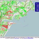
A dynamic map overlay showing the Road Status after the Earthquake in Sendai, Japan, based on the user generated maps from OpenStreetMap has been generated by Pascal Neis, member of the GIScience Research Group of the University...
Wednesday, March 16th, 2011
Sahana is a Free and Open Source Disaster Management system. It is a web based collaboration tool that addresses the common coordination problems during a disaster from finding missing people, managing aid, managing volunteers, tracking camps effectively...

Wednesday, March 16th, 2011
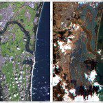
The images were acquired by the German Optical RapidEye and radar TerraSAR-X satellites. They show Torinoumi on the eastern coast of Japan before the disaster on 5 September 2010 and after the tsunami on 12 March 2011....
Wednesday, March 16th, 2011
Kei Furuta, managing director of Equinix Japan says the company has arranged for priority deliveries of diesel fuel so that both data centers can continue running through the blackout periods that the local utility Tokyo Electric Power...
Tuesday, March 15th, 2011
A Japan Trends Map is now available from Esri. The map visualizes a heat map of aggregated reports or reports categorized by property damage, hazards, evacuations, power outages, or...
Sunday, March 13th, 2011
The devastation following the 8.9m earthquake in Japan and, closer to home, last month's lethal quake in Christchurch has many asking what science is actually doing to find a way of forewarning of major earthquakes. Read More
Sunday, March 13th, 2011
RapidEye has acquired two scenes over the West Coast of Honshu Island on Marth 12th. The satellites are already tasked again to image on Sunday, March 13th. The Center for Satellite Based Crisis Information (ZKI) which is part...

Sunday, March 13th, 2011
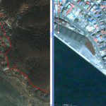
Detailed satellite images of the territory of Japan were received, where a series of earthquakes were registered on March 11 in its north-eastern parts. According to the Main Meteorological Service of the country the 8.9 magnitude earthquake...