Thursday, August 13th, 2015
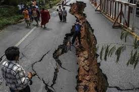
Crowdsourcing has added a new dimension to Nepal’s disaster response capability following the massive earthquake that struck this Himalayan country on 25 April, killing more than 8,000 people, injuring thousands and leaving tens of thousands displaced. Government...
Thursday, March 22nd, 2012
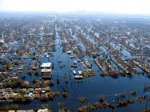
Mapping plays an important role during disaster and disease outbreaks. The city of Pune in India is experiencing an outbreak of H1N1 influenza this week, and mapping is being employed to meet the challenge. At the same...
Wednesday, March 14th, 2012
The joint GSDI World Conference (GSDI 13), the 14th GEOIDE Annual Scientific Conference, the 7th 3DGeoInfo Conference...
Friday, March 9th, 2012
Australia is once again experiencing flooding and it is expected that flooding will result in nearly $1 billion of damage. Although waters have receded in some places, more rains are expected over the next few days and...
Thursday, February 23rd, 2012
GeoEye, Inc. announced that it will jointly develop a new crisis response imagery service with Esri, the leading global geographic information software provider. This service, expected to be released this spring, will augment Esri's current disaster response capability...
Thursday, February 9th, 2012
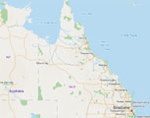
The Queensland government has recently provided a Community Intelligence Map (CIM) that provides a portal for the public to search for information when disasters happen. The map is an adjunct of the Total Opeartional Mapping (TOM) system...
Tuesday, December 27th, 2011
Seven years after a devastating tsunami struck Sri Lanka, more work still needs to be done to secure an effective early-warning system, officials say. More than 30,000 Sri Lankans lost their lives in the Indian Ocean tsunami...
Saturday, November 19th, 2011
The plan drawn up by Australia and Indonesia - which hosts the East Asia Summit beginning in Bali today - would involve countries including China and the US instantly sharing sensitive satellite images, damage and casualty reports...
Wednesday, November 16th, 2011
This study used 180 transects perpendicular to over 100 km on the west coast of Aceh, Indonesia to analyze the influence of coastal vegetation, particularly cultivated trees, on the impact of the 2004 tsunami. Satellite imagery; land cover...