Monday, June 20th, 2016
Pune: The Pune Municipal Corporation is consulting Space Application Centre, Indian Space Research Organisation, Ahmedabad, for using high resolution remote sensing picture data to keep a tab on encroachments and creating a 3D model of the city...

Friday, March 9th, 2012
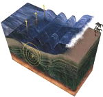
The Japan Tsunami disaster resulted in a proliferation of mapping and cartographic production. This resulted from the many needs of people to identify and provide emergency services, to enable protective services, assist in geophysical studies and to...
Thursday, March 8th, 2012
Sescoi is expanding its Asian network of offices and distributors by appointing WCS Solution as Malaysian distributor for its WorkNC CADCAM software, and for WorkXPlore 3D, its high speed view, mark-up and analysis system. Read More
Friday, February 24th, 2012
Baku3D company reports that now through online navigator Go Map www.baku3d.az users will have a chance to make virtual tours not only over the country on the whole , but more closely- in parks, museums, mosques, historical monuments, restaurants,...
Thursday, January 26th, 2012
Tekla BIMsight now offers a well-designed user interface for Windows tablet computers, thereby enabling use at construction sites. As before, it is still the easiest-to-use BIM tool available for everyone in the construction industry to download and use for free. New...
Wednesday, January 25th, 2012
In construction today, projects are economically designed in precise 3D, so it makes perfect sense to build them the same way. With increasing project overheads due to materials, fuel & labour costs, combined with pressure to drive...
Tuesday, January 24th, 2012
Magnasoft’s 3D laser scanning division employs the best of the brains in the industry with immense domain knowledge that positions Magnasoft as a leader in 3D Laser scanning services. Laser triangulation is one of the most common techniques...
Monday, January 23rd, 2012
The ARBOTOM determines tree defects in 3D including stem quality using acoustic sensors. Pulses are transmitted through trees and return signals that provide an indication of the disease levels. Read More
Thursday, January 12th, 2012
The Survey of India (SOI) has embarked upon a project for creating a national topographic database on a 1:10,000 scale for the entire country and aims to complete it during the 12th plan period, Surveyor General of...