Asian Surveying & Mapping
Breaking News
Nuri rocket successfully completes KAIST’s next-gen satellite mission
The Korea Advanced Institute of Science and Technology (KAIST)...
President Lai reviews progress on first indigenous satellite constellation
President Lai Ching-te said developing space technology is a...
Japan’s iQPS lines up eight SAR launches
ST. LOUIS — Japan’s Institute for Q-shu Pioneers of...
UAE Astronauts Promote AI and Collaboration in Space at GITEX Europe
The Arab world’s first astronaut, Hazzaa Al Mansouri, and...
New species of space-adapted bacteria discovered on China’s Tiangong space station
Scientists have discovered a previously unknown strain of microbe...
Isro’s 101st mission fails as PSLV-C61 suffers third-stage anomaly
India’s latest Earth observation satellite mission faced a setback...
Iraq’s First Fully Solar-Powered Village in Kulak Is Now Operational
ERBIL, Kurdistan Region – May 20, 2025 — The...
Australia’s Gilmour Space Technologies ready to launch maiden Eris Test flight the nation’s first orbital launch in over 50 years
Gilmour Space Technologies is the leading launch services company...
Korea’s space agency seeks revision of plan to modify next-gen rockets into reusable system
South Korea's aerospace agency said on Thursday that it...
UAE Space Agency Signs Agreement With Technology Innovation Institute to Execute the Emirates Mission to the Asteroid Belt’s Lander Project
In the presence of His Highness Sheikh Hamdan bin...
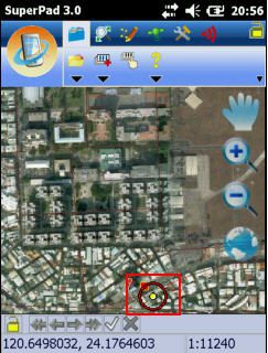
SuperPad 3.0a

1. Integration with SuperGIS Server 3: SuperPad 3.0a supports to edit the map distributed by SuperGIS Server 3, which allows multi-users to read, add, edit features and attribute data, and synchronize map data. It helps users manage the files effectively and avoid losing data from overwriting the files.  

2. Creating Graphics Layer: On Graphics Layer, users can add various kinds of graphics at the same layer, including point, polyline, polygon graphics, and texts so that users can rapidly record the information.  

3. Laser Rangefinder Extension: SuperPad 3.0a supports to work with LaserCraft Contour XLR and TruPulse360/360B to measure in the field. Users can use GPS position as datum or use reference point as datum to get the centroid information, such as Slope Distance, Horizontal Distance, Vertical Distance, etc.  

4. Reading Cached Map: SuperPad 3.0a supports to read the Cached Map (*.sgt) generated by SuperGIS Map Tile Tool to greatly improve the map performance. SGT file is not editable but contains spatial information. In that case, the map performance on mobile device will not be influenced while reading large quantities of vector layers.  

Moreover, SuperPad 3.0a can work with SuperGIS Desktop 3 and SuperGIS Server 3 to complete the effective GIS workflow and improve the work efficiency. About the details and the free trial of SuperPad 3.0a, please visit our website www.supergeotek.com.

As to the list of bug fixed in the latest version, please refer to SuperGeo GIS Forum http://www.supergeotek.com/Forum/default.aspx?g=forum.