SLOPE3D extends capabilities of GeoStudio’s trusted 2D SLOPE/W product into 3D, significantly enhancing stability assessments for slopes in the mining and civil industries.
CALGARY, CANADA – Seequent, The Bentley Subsurface Company, today announced the release of SLOPE3D, an advanced slope stability analysis tool that empowers geotechnical engineers and engineering geologists to design safer slopes.
Building on the capabilities of GeoStudio’s trusted 2D SLOPE/W product, SLOPE3D is an intuitive limit equilibrium solution for analyzing rock and soil slopes in mining and civil projects – for example, hillslopes, open pit mines, and engineered structures such as dams and levees.
Chris Kelln, Director, Technical Solutions for GeoStudio, said, “SLOPE3D combines the most up-to-date research on 3D slope analysis techniques with the capabilities in SLOPE/W, a trusted tool for assessing 2D slope stability for over 30 years, providing a practical approach for capturing slope failure mechanisms for simple to complex geotechnical models.”
“Ensuring the safety and reliability of engineered projects is at the heart of geotechnical engineering,” Kelln added. “We specifically designed SLOPE3D to empower geotechnical and geological engineers to make confident decisions, improve safety, reduce project risks and costs, and ultimately design better infrastructure.”
GeoStudio’s powerful and easy-to-use interface provides a unique modelling and analysis experience. Multiple 3D geometries and analyses can be added to a single project and solved simultaneously. Geo-professionals can include SLOPE3D analyses in existing 2D stability projects for efficient results comparison.
SLOPE3D connects directly with Seequent’s geological modelling software, Leapfrog, via Seequent Central, and integrates with GeoStudio’s SEEP3D. This creates a seamless workflow with smooth data exchange and simpler data management to improve project accuracy and outcomes.
SLOPE3D can be purchased now from Seequent. See the new SLOPE3D product page for more information, release announcement video, and a free trial. SLOPE3D is part of the GeoStudio 2023 release.
Download high resolution images, and product video
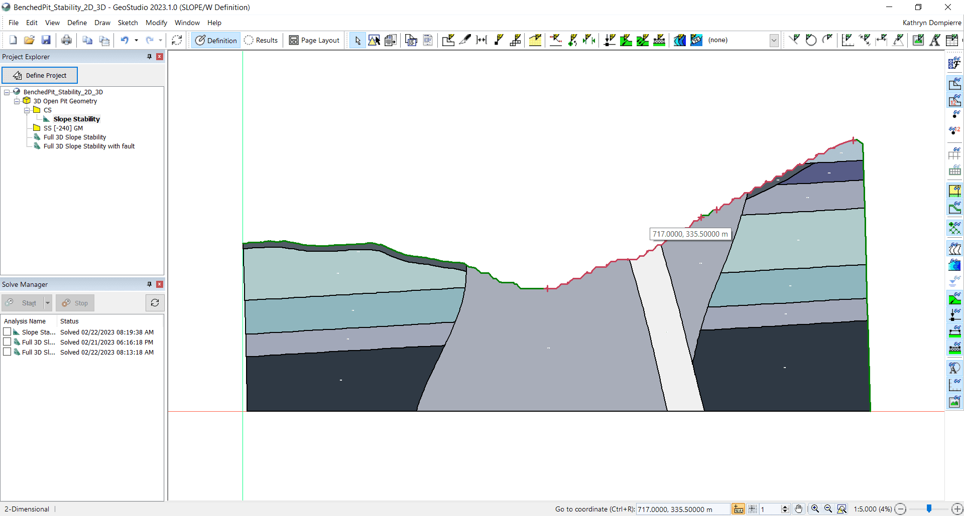
Figure 2: SLOPE/W 2D cross-section of a benched open pit mine. Now you can expand your analysis into 3D within the same project file.
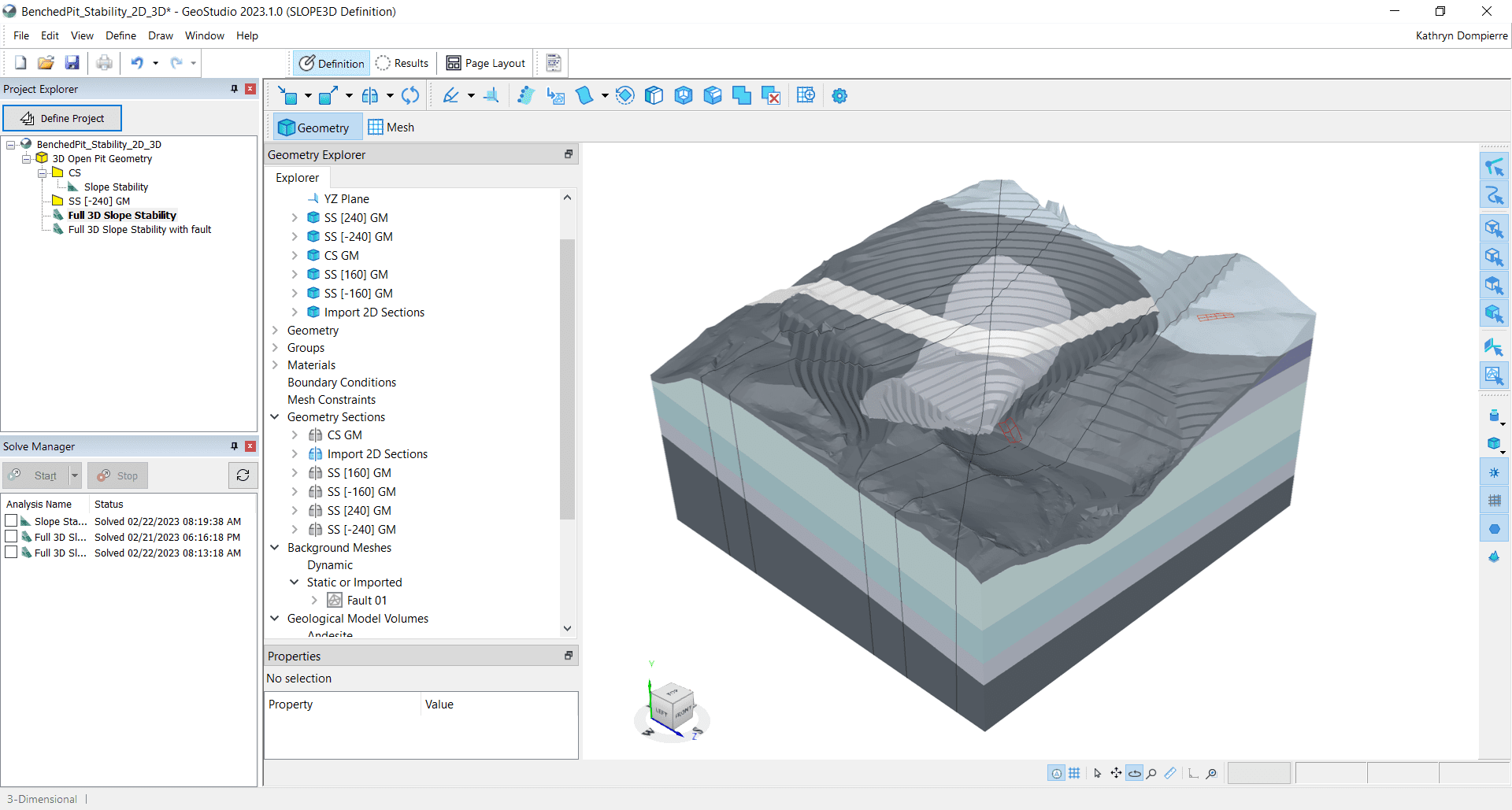
Figure 3: The same benched mine pit but now in SLOPE3D.
Other use cases descriptions, for use with stock photography
About Seequent
Seequent builds world-leading subsurface software, helping to create a better understanding of the earth to ensure a better world for all.
We are constantly evolving at the forefront of technology to transform how geo-professionals work, eliminating barriers to understanding the earth’s challenges by connecting teams with the tools they need.
Every day, our customers in over 100 countries work to develop mineral resources more sustainably, design and build better infrastructure, protect the environment, source renewable energy, and help resolve historical challenges such as groundwater contamination and ageing infrastructure.
Our integrated earth modelling, geo-data management, and team collaboration software enables our customers to see a more complete picture of the earth: because with more understanding comes better decisions – for people and the planet.
Headquartered in New Zealand with global reach, Seequent is the subsurface software company within Bentley Systems, Incorporated. Together, we are helping build a more resilient world. www.seequent.com
