Asian Surveying & Mapping
Breaking News
bitsensing Signs MOU with IKIO Technologies to Advance AI-Based Traffic Monitoring on India’s Expressways, Highways and Municipal Areas
Backed by proven success in South Korea and Europe,...
Nuri rocket successfully completes KAIST’s next-gen satellite mission
The Korea Advanced Institute of Science and Technology (KAIST)...
President Lai reviews progress on first indigenous satellite constellation
President Lai Ching-te said developing space technology is a...
Japan’s iQPS lines up eight SAR launches
ST. LOUIS — Japan’s Institute for Q-shu Pioneers of...
UAE Astronauts Promote AI and Collaboration in Space at GITEX Europe
The Arab world’s first astronaut, Hazzaa Al Mansouri, and...
New species of space-adapted bacteria discovered on China’s Tiangong space station
Scientists have discovered a previously unknown strain of microbe...
Isro’s 101st mission fails as PSLV-C61 suffers third-stage anomaly
India’s latest Earth observation satellite mission faced a setback...
Iraq’s First Fully Solar-Powered Village in Kulak Is Now Operational
ERBIL, Kurdistan Region – May 20, 2025 — The...
Australia’s Gilmour Space Technologies ready to launch maiden Eris Test flight the nation’s first orbital launch in over 50 years
Gilmour Space Technologies is the leading launch services company...
Korea’s space agency seeks revision of plan to modify next-gen rockets into reusable system
South Korea's aerospace agency said on Thursday that it...

February 18th, 2021
PH Engineering announces support for DJI M300

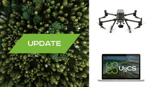
Riga, Latvia  – SPH Engineering announces the release of UgCS update, adding the support for DJI M300. UgCS supports all flight planning patterns of DJI M300 such as Photogrammetry, Corridor mapping and Facade inspections.

UgCS allows to manage the following route parameters: speed, altitude, heading, camera attitude, camera triggering modes (by time, and by distance), turn types (Stop&Turn or Adaptive Bank turn). It also supports video recording in Full Motion Video format.

In addition, UgCS support for DJI M300 cameras covers displaying videos from both FPV and main camera (H20/H20T) on the UgCS for DJI screen; switching between main camera lenses: wide, zoom, thermal (for H20T); changing general settings of the active lens; manual camera triggering in all modes (wide/zoom/thermal) and video recording.

‘We have tested DJI M300 in various scenarios and can confirm that it can be used in extreme weather scenarios, including low temperatures while battery capacities are significantly improved. The drone is smart and safe, equipped with various cameras and sensors. But the most awaited improvement is Waypoints 2.0 which allows to create up to 65,535 waypoints and set multiple actions for one or more payloads. This improvement is crucial for UgCS as it allows, in particular, to fly long routes in terrain following mode with UgCS’, Alexei Yankelevich, head of software development at SPH Engineering, comments.