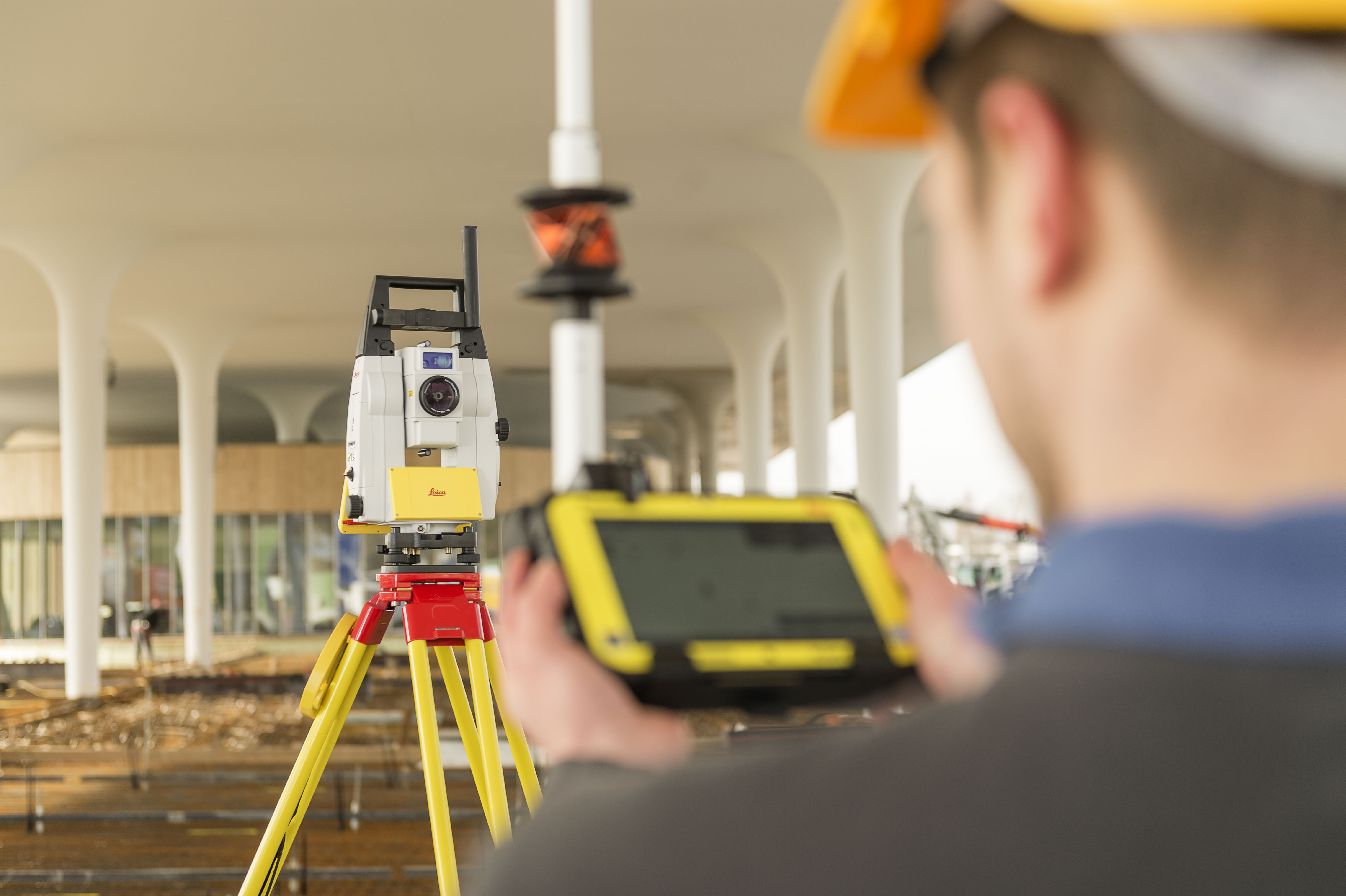
(Heerbrugg, Switzerland) – Leica Geosystems, part of Hexagon, industry leader of measurement technology, announced today the new Leica iCON construction total stations, Leica iCR70 and Leica iCR80, the most productive one-person layout solution for building construction.

The new Leica iCON construction total stations are the fastest, most reliable, easy-to-use layout solution where users are in charge of dataflow.
The intuitive new iCON construction total stations increase efficiency on any building construction site by automatically identifying the prism and automatically relocking to it, should the line of sight be lost, delivering the most reliable, simple and automated setup routine for construction layout. The iCON layout solution, consisting of the new iCON construction total stations, the Leica iCON CC80 field tablet and an enhanced version of the iCON build field software, is aligned with modern Building Information Modelling (BIM) processes and provides a simplified and seamless dataflow of fully rendered 3D design models, between the office and field and vice versa.
“The iCON build Layout Objects App allows us to set out straight from a model and gives us all the information in one place. We can move around the model, hide elements and simplify areas within elevation parameters. This allows specific objects to be selected, set out and displayed on the controller in 3D without any prior data manipulation,” said James Gault, senior site engineer at John Sisk & Son, an international construction company. “Leica iCON equipment has been invaluable enabling our engineers to make more efficient use of their time, increase productivity, and improve accuracy and quality.”
Guaranteed layout efficiency
The iCR70 and iCR80 total stations offer a simple and guided setup routine designed to automatically search and identify targets, and the most stable lock onto the prism for doing construction layout of design data. Users experience approximately an 80 per cent increase in productivity over other conventional layout practices with tapes and strings.
Flexible 3D model data handling
The iCON layout solution allows flexible handling of fully-rendered 3D design models between field and office. Users have full flexibility to select their work packages by objects on site at every stage of construction with simple yet powerful filter mechanisms increasing efficiency on construction sites.
“We created the new iCON layout solution for construction professionals who need to capture complex reality and lay out complex designs,” said Bernd Möller, Leica Geosystems business director of geomatics field solutions. “Users can lay out more points every day with accuracy and confidence due to the new robotic construction total stations with the most stable prism lock for a construction total station, guided setup processes and continuous quality checks. The new iCON layout solution accelerates construction and installation processes.”
For more information about the new Leica iCON construction total stations, please visit: https://leica-geosystems.com/leica-icr70
https://leica-geosystems.com/leica-icr80
For more information about the Leica iCON build field software v4.0, please visit: http://leica-geosystems.com/icon-build
Leica Geosystems – when it has to be right
Revolutionising the world of measurement and survey for nearly 200 years, Leica Geosystems, part of Hexagon, creates complete solutions for professionals across the planet. Known for premium products and innovative solution development, professionals in a diverse mix of industries, such as surveying and engineering, safety and security, building and construction, and power and plant, trust Leica Geosystems to capture, analyse and present smart geospatial data. With the highest-quality instruments, sophisticated software, and trusted services, Leica Geosystems delivers value every day to those shaping the future of our world.
Hexagon is a global leader in digital solutions that create Autonomous Connected Ecosystems (ACE). Hexagon (Nasdaq Stockholm: HEXA B) has approximately 18,000 employees in 50 countries and net sales of approximately 3.5bn EUR. Learn more at hexagon.com and follow us @HexagonAB.