Asian Surveying & Mapping
Breaking News
South Korea is converting an abandoned coal mine into a moon exploration testing ground
South Korea is transforming abandoned coal mines into testing...
ISRO to Launch Chandrayaan-5 With Japan, Plans Space Station
Dr. V. Narayanan, Chairman of the Indian Space Research...
Russia and China are threatening SpaceX’s Starlink satellite constellation, new report finds
SpaceX's Starlink satellite constellation is facing threats from Russia...
China and Pakistan agree to fly 1st foreign astronaut to Chinese space station
For the first time, the Chinese space program will train...
ISRO’s “Space on Wheels” offers a peek into Indian Space Programme to students in Karimnagar
The Indian Space Research Organisation (ISRO)’s “Space on Wheels”...
Geospatial led solutions build the foundations for better decision-making
Geo Connect Asia 2025 paves the way for turning...
GEOSA, Singapore Land Authority Launch Achievements of Joint Geospatial System Project
Riyadh, SPA -- The General Authority for Survey and...
Building in Bangkok collapses as powerful earthquake hits southeast Asia
One person has died and 50 were injured in...
Bellatrix Aerospace Partners with Astroscale Japan for Space Debris Removal
Bellatrix Aerospace, a Bengaluru-based space mobility company, has joined...
NSTC announces Pingtung site as Taiwan’s space mission launch center
Taipei, March 26 (CNA) Taiwan's National Science and Technology...

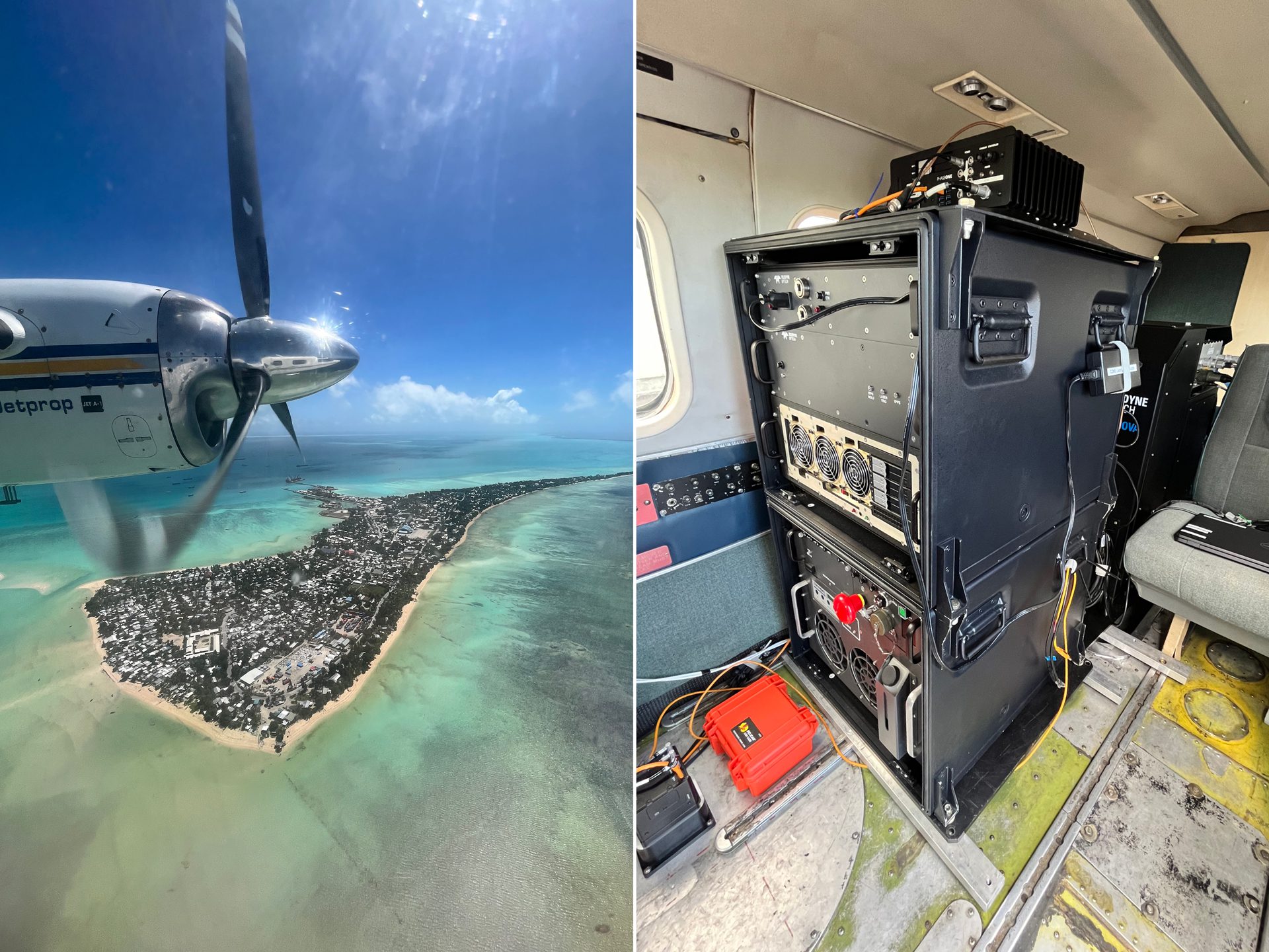
Tetra Tech won three MAPPS Awards for a single project using the Teledyne Optech CZMIL SuperNova. The awards include the MAPPS Award for Airborne Acquisition and Processing, the MAPPS Member Choice Award and the MAPPS Grand Award. 

The project involved a comprehensive hydrographic survey in the Republic of Kiribati in the Central Pacific. The technology used in this project included the CZMIL SuperNova, Starlink for remote network access, Garmin satellite messengers and a solar panel array to support power needs. 

“Working for the Kiribati Nation was a rare opportunity to work with native islanders to safeguard their future against changing coastlines and sea levels,” says Eric Woolery, Tetra Tech’s airborne acquisition manager. “Given that it is one of the lowest-lying nations in the world, a complete hydrographic survey will prove to be a vital tool to help plan economic growth, improve maritime safety, and increase coastal resilience.” 

Image Credit: Tetra Tech/Teledyne