
Asian Surveying & Mapping
Breaking News
OMEGA and MBRSC launch exhibition celebrating UAE’s space milestones and Moon landing anniversary
OMEGA has partnered with the Mohammed Bin Rashid Space...
SpaceX crash site on moon revealed by South Korean orbiter
An out-of-control SpaceX rocket that crashed into the moon...
ispace Receives Grant for Japan’s Space Strategy Fund Project “High-Precision Landing Technology in the Lunar Poles Region”
TOKYO—August 7, 2026—ispace, inc. (ispace) (TOKYO: 9348), a global...
Embry‑Riddle Asia Launches Professional Space Operations Course in Singapore Amid Regional Space Boom
As Singapore works to develop its involvement in the...
ISRO to map landslides in J&K using satellite to generate alerts
According to the government, geospatial technologies are being used...
Korea to Build 3D ‘New National Map’ Under Spatial Data Strategy
The Korean government will shift its spatial information system,...
Uzbekistan-China Satellite Project Advances with AI Module
Uzbek engineers are developing an onboard artificial intelligence module...
Thailand sees no impact from Cambodia’s plan for UN map recognition
Thailand's Foreign Minister stated that Cambodia's plan to seek...
Japan repeats Dokdo claim while calling South Korea a partner
Tokyo's 2026 defense white paper highlights territorial tensions alongside...
China unveils comprehensive geological map of Moon
China has completed a 1:5,000,000-scale geological map of the...

October 28th, 2024
Scientists Exploring Palau National Marine Sanctuary 

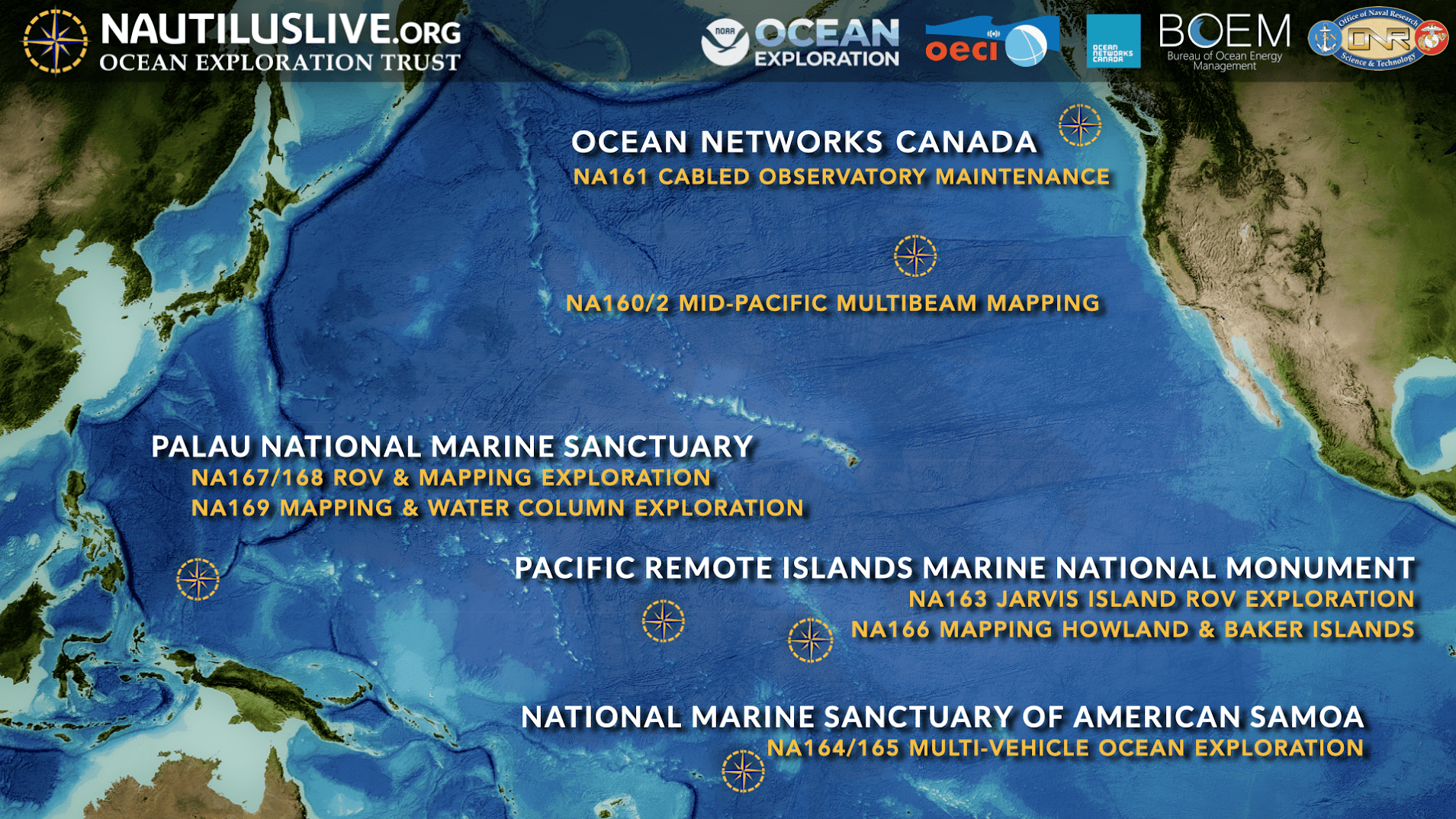
On Oct. 28, 2024, an ocean exploration expedition named Lebuu’s Voyage set sail aboard Ocean Exploration Trust’s (OET) Exploration Vessel (E/V) Nautilus to explore deep-sea habitats within Euotelel a Klingil a Debel Belau, the Palau National Marine Sanctuary (PNMS). Eleven local scientists, educators, cultural liaisons and early career professionals are part of this interdisciplinary expedition team led by Ocean Exploration Trust in close partnership with the Palau International Coral Reef Center (PICRC) and NOAA Ocean Exploration.  

Over the next three weeks, two back-to-back expeditions will gather seafloor mapping data and explore the seafloor with remotely operated vehicles to illuminate deep-sea habitats around Palau. These expeditions are funded by NOAA Ocean Exploration via the Ocean Exploration Cooperative Institute as the first step in fulfilling the U.S. Government commitment made at the 7th Our Ocean Conference to support ocean mapping of the PNMS and are part of its “Beyond the Blue: Illuminating the Pacific” campaign. All data gathered will be provided to the Palauan government and PICRC to support and enable additional follow-on exploration and management activities to better understand and care for the ocean.