
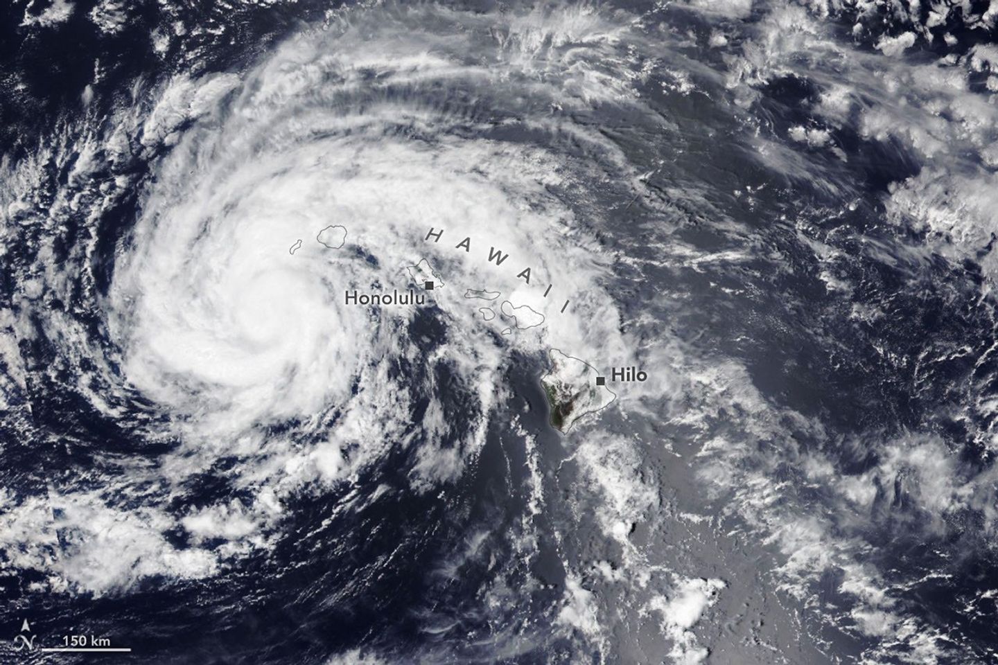
Hurricane Lala approached Hawaiʻi in mid-August 2026, bringing heavy rainfall, strong winds and dangerous surf to portions of the island chain.
The VIIRS (Visible Infrared Imaging Radiometer Suite) on the Suomi NPP satellite captured this image on Aug. 16, 2026, as Lala churned just south of Hawaiʻi. The storm’s broad cloud field stretched across much of the region as its center passed south of the islands.
Lala brought flooding rains and damaging winds to parts of Hawaiʻi before continuing westward across the central Pacific.
Image Credit: NASA Earth Observatory images by Lauren Dauphin
