Asian Surveying & Mapping
Breaking News
Japan Eyes Sovereign D2D Satellite Network
Japan plans to select a proposal this month for...
China schedules Long March 10B rocket launch and recovery attempt
HELSINKI — China is set for a debut flight...
BRICS space agencies meet begins in Bengaluru
Heads and senior representatives of the space agencies of...
“India’s growing space ecosystem to drive global collaboration”, says ISRO Chairman V Narayanan after BRICS Space Agencies Meeting
"India's growing space ecosystem to drive global collaboration", says...
UAE aims to see Emirati on Moon in next 10 years, says MBRSC chief
UAE expects to have a presence on the Moon within...
Safran, SatSure partner to develop geospatial intelligence solutions for India
French aerospace giant Safran Electronics & Defense and Indian...
Singapore unveils road map to help develop international business standards and conformance
Singapore has unveiled plans to help develop international standards...
Adelaide University to run space and defence venture launchpad ahead of Australian Space Forum
Adelaide University’s Innovation & Collaboration Centre (ICC) will deliver...
Japan’s H3 rocket returns to space with successful launch after December setback
Japan’s flagship H3 rocket has returned to flight six...
KONGSBERG accelerates seabed mapping developments with Ocean Exploration Trust expedition aboard Exploration Vessel Nautilus
KONGSBERG and the Ocean Exploration Trust (OET) are set...

November 21st, 2023
Trailblazing New Earth Satellite Put to Test in Preparation for Launch 

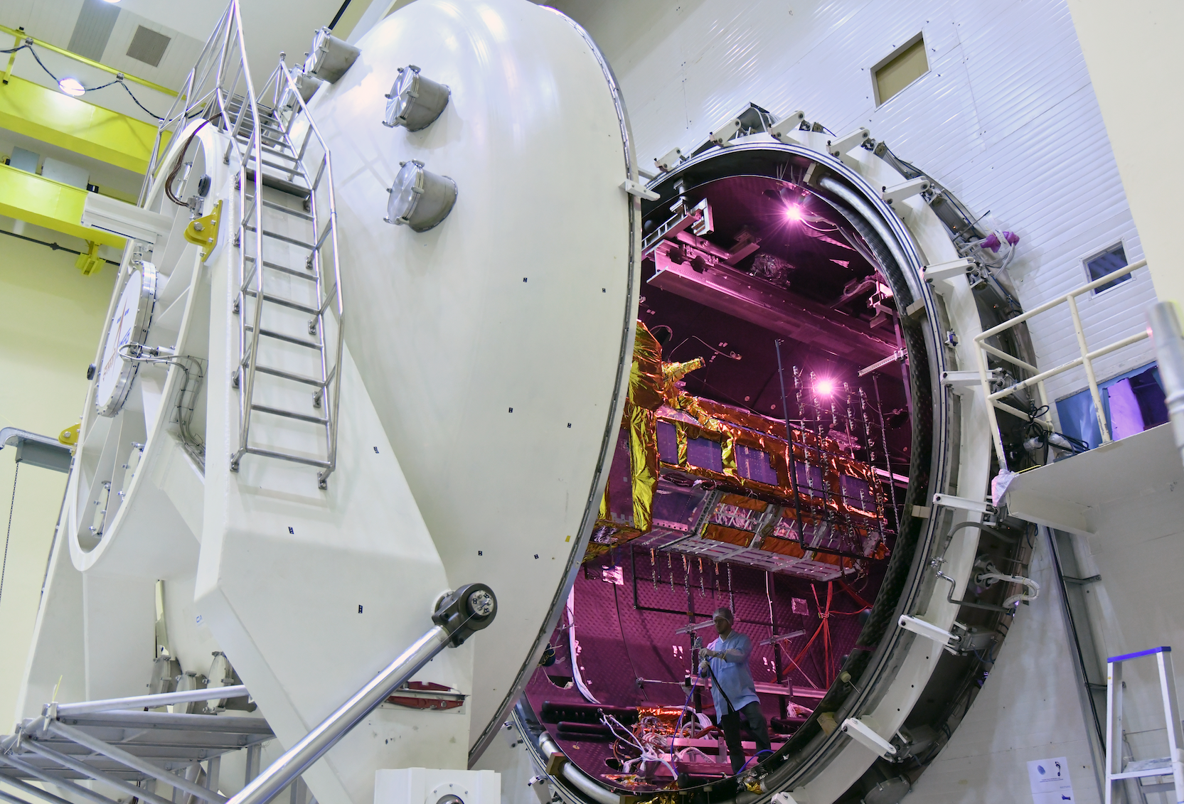
NISAR, the trailblazing Earth-observing radar satellite being developed by the United States and Indian space agencies, passed a major milestone on Nov. 13, 2023, emerging from a 21-day test aimed at evaluating its ability to function in extreme temperatures and the vacuum of space. 

Short for NASA-ISRO Synthetic Aperture Radar, NISAR is the first space hardware collaboration between NASA and the Indian Space Research Organisation (ISRO) on an Earth-observing mission. Scheduled to launch in early 2024, the satellite will scan nearly all the planet’s land and ice twice every 12 days, monitoring the motion of those surfaces down to fractions of an inch. It will be able to observe movements from earthquakes, landslides and volcanic activity and track dynamic changes in forests, wetlands and agricultural lands. 

The thermal vacuum test occurred at ISRO’s Satellite Integration and Test Establishment in the southern Indian city of Bengaluru. It’s one of a battery of tests the satellite will face leading to launch. Other tests will ensure it can withstand the shaking, vibration and jostling that it will encounter during launch.