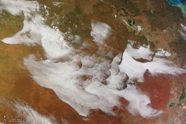

An unusual collection of clouds appeared over the interior of Australia on the morning of July 5, 2023. The Moderate Resolution Imaging Spectroradiometer (MODIS) on NASA’s Terra satellite captured this image of the stunning display, which stretched for more than 1,000 kilometers (600 miles) over Western Australia and the Northern Territory.
Several experts in cloud dynamics who looked at the image found the patterns to be both odd and fascinating, and they could not say with certainty what caused the complex formations based on the image alone. However, meteorological observations from that time offer clues into what may have been going on.
“We know that gravity wave cloud fields are quite common in a stable atmosphere,” said Yi Huang, atmospheric scientist at the University of Melbourne. According to temperature profile data, the atmosphere on the morning of July 5 was very stable and well-stratified, with a sharp temperature inversion at the top of the atmospheric boundary layer. Disturbances, which can occur when air encounters small ridges and valleys, will produce wave textures in the clouds that look like ripples on a pond. Indeed, in the detailed view below, we see these finer-scale textures within the large clouds.
Image Credit: NASA Earth Observatory images by Wanmei Liang, using MODIS data from NASA EOSDIS LANCE and GIBS/Worldview