Asian Surveying & Mapping
Breaking News
South Korea is converting an abandoned coal mine into a moon exploration testing ground
South Korea is transforming abandoned coal mines into testing...
ISRO to Launch Chandrayaan-5 With Japan, Plans Space Station
Dr. V. Narayanan, Chairman of the Indian Space Research...
Russia and China are threatening SpaceX’s Starlink satellite constellation, new report finds
SpaceX's Starlink satellite constellation is facing threats from Russia...
China and Pakistan agree to fly 1st foreign astronaut to Chinese space station
For the first time, the Chinese space program will train...
ISRO’s “Space on Wheels” offers a peek into Indian Space Programme to students in Karimnagar
The Indian Space Research Organisation (ISRO)’s “Space on Wheels”...
Geospatial led solutions build the foundations for better decision-making
Geo Connect Asia 2025 paves the way for turning...
GEOSA, Singapore Land Authority Launch Achievements of Joint Geospatial System Project
Riyadh, SPA -- The General Authority for Survey and...
Building in Bangkok collapses as powerful earthquake hits southeast Asia
One person has died and 50 were injured in...
Bellatrix Aerospace Partners with Astroscale Japan for Space Debris Removal
Bellatrix Aerospace, a Bengaluru-based space mobility company, has joined...
NSTC announces Pingtung site as Taiwan’s space mission launch center
Taipei, March 26 (CNA) Taiwan's National Science and Technology...
  • Jan 28, 2020
  • Comments Off on Agreement on Data Utilization of Earth Observation Satellite with FAO
  • Feature
  • 766 Views

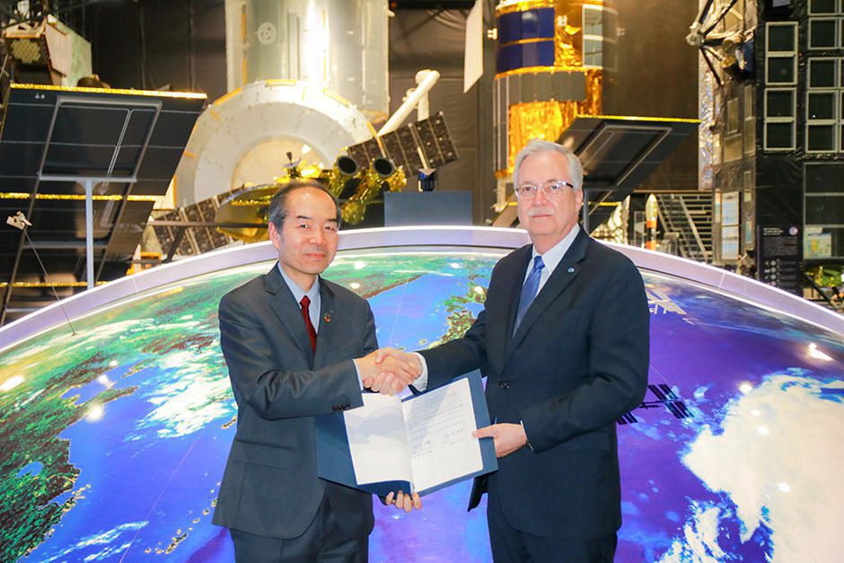
Japan Aerospace Exploration Agency (JAXA) agreed to collaborate with Food and Agriculture Organization of the United Nations (FAO) on data utilization of Earth-observation satellites. Imai Ryoichi (left), JAXA vice president, and Daniel Gustafson (right), FAO’s Deputy Director-General for Programmes, signed the Memorandum of Understanding at JAXA Tsukuba Space Center on Jan. 23, 2020.

Leveraging this cooperation, JAXA and FAO will be monitoring forests and mangroves around the world by JAXA’s satellites with L-band Synthetic Aperture Radar (SAR). 

Only JAXA has observed forest using L-band radar (SAR) technology from 1992. Observation data of global forests that JAXA has been accumulating for over 25 years will be provided to the System for Earth Observation Data Access, Processing and Analysis for Land Monitoring (SEPAL), which is FAO’s toolkit for monitoring forest and land-use. Additionally, this cooperation supports JAXA to improve the accuracy of its satellite data.