Asian Surveying & Mapping
Breaking News
Australian Space Agency funds development of aerospace-grade GNSS receiver
The Australian Space Agency has funded the development of...
Continuity risks for Australian EO data access
A new report details the widespread use of Earth...
China launches new remote sensing satellite
JIUQUAN, April 15 (Xinhua) -- China on Monday launched...
7.4-Magnitude Earthquake Strikes Taiwan
A major, 7.4-magnitude earthquake struck the eastern coast of...
Tata Deploys Its Geospatial Satellite In Space on Space X’s Falcon 9 Rocket
THIRUVANANTHAPURAM: Tata Company launched India's first private commercial satellite...
Taiwan’s Formosat-8 Satellite Set for Launch by 2025
The Taiwan Space Agency has announced progress on the...
Iranian Scientists to Build Satellite Constellation for 2 Simultaneous Missions
The scientists at the knowledge-based company had previously succeeded...
China provides geospatial intel and other military support to Russia, US says
The US has warned its European allies that China...
Japanese lunar lander company ispace raises $53.5 million in stock sale
WASHINGTON — Japanese lunar lander developer has raised $53.5...
Esri and Prince Sultan University Advance GIS Education Through Strategic Partnership
Memorandum of Understanding with Institution Enhances GIS Curriculum and...

A PSLV-C43 rocket lifted off on Nov. 29, 2018, from the Satish Dhawan Space Centre SHAR, Sriharikota, and successfully launched India’s Hyper spectral Imaging Satellite (HysIS) and 30 international co-passenger satellites.

HysIS is an Earth observation satellite configured around ISRO’s Mini Satellite-2 bus. The primary goal of HysIS is to study Earth’s surface in visible, near infrared and shortwave infrared regions of the electromagnetic spectrum.

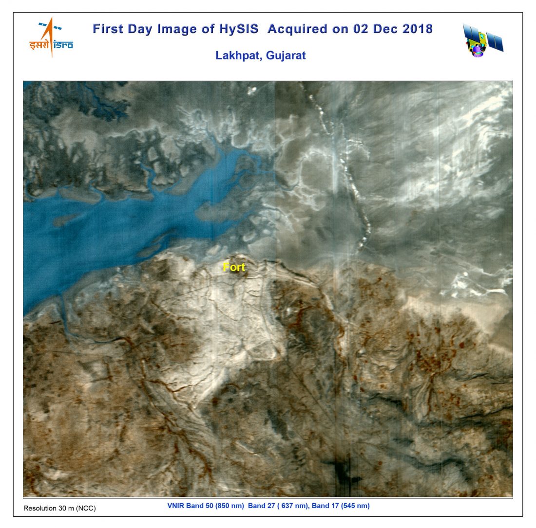
The first daytime image from HysIS was acquired at NRSC Hyderabad on Dec. 2, 2018, covering parts of Lakhpat in Gujarat. The sample color composite image represents VNIR spectral bands.