Asian Surveying & Mapping
Breaking News
bitsensing Signs MOU with IKIO Technologies to Advance AI-Based Traffic Monitoring on India’s Expressways, Highways and Municipal Areas
Backed by proven success in South Korea and Europe,...
Nuri rocket successfully completes KAIST’s next-gen satellite mission
The Korea Advanced Institute of Science and Technology (KAIST)...
President Lai reviews progress on first indigenous satellite constellation
President Lai Ching-te said developing space technology is a...
Japan’s iQPS lines up eight SAR launches
ST. LOUIS — Japan’s Institute for Q-shu Pioneers of...
UAE Astronauts Promote AI and Collaboration in Space at GITEX Europe
The Arab world’s first astronaut, Hazzaa Al Mansouri, and...
New species of space-adapted bacteria discovered on China’s Tiangong space station
Scientists have discovered a previously unknown strain of microbe...
Isro’s 101st mission fails as PSLV-C61 suffers third-stage anomaly
India’s latest Earth observation satellite mission faced a setback...
Iraq’s First Fully Solar-Powered Village in Kulak Is Now Operational
ERBIL, Kurdistan Region – May 20, 2025 — The...
Australia’s Gilmour Space Technologies ready to launch maiden Eris Test flight the nation’s first orbital launch in over 50 years
Gilmour Space Technologies is the leading launch services company...
Korea’s space agency seeks revision of plan to modify next-gen rockets into reusable system
South Korea's aerospace agency said on Thursday that it...

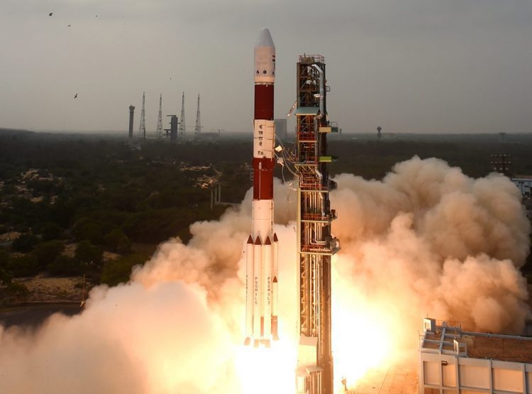
On Dec. 7, 2016, the Indian Space Research Organisation (ISRO) Polar Satellite Launch Vehicle successfully took of from the Satish Dhawan Space Center and placed ISRO’s RESOURCESAT-2A remote-sensing satellite into orbit. The satellite weighs 1,235 kilograms and was injected into an 817-kilometer polar sun-synchronous orbit at around 20 minutes into the flight.

RESOURCESAT-2A carries three payloads: a high-resolution linear imaging self-scanner (LISS-4) camera operating in three spectral bands in the visible and near-infrared region (VNIR) with 5.8-meter spatial resolution and a five-day revisit capability; a medium-resolution LISS-3 camera operating in three spectral bands in VNIR and one in the shortwave infrared (SWIR) band with 23.5-meter spatial resolution; and a coarse-resolution advanced wide-field sensor (AWiFS) camera operating in three spectral bands in VNIR and one band in SWIR with 56-meter spatial resolution.

RESOURCESAT-2A also carries two solid-state recorders with 200GB each to store image data taken by its cameras, which can be read out later to ground stations.

4-c36005

RESOURCESAT-2A was aboard the 38th flight of ISRO’s Polar Satellite Launch Vehicle.

The resource-mapping satellite is expected to aid in urban planning and crop monitoring as well as improve emergency response to natural disasters. The mission will track agriculture, water resources, soil contamination and the growth of Indian cities.