Asian Surveying & Mapping
Breaking News
Launch of Australia’s 1st orbital rocket, Gilmour Space’s Eris-1, delayed again
Update for 6:15 p.m. ET on July 1: Gilmour Space...
SAASST, UAE Space Agency strengthen scientific partnership
SHARJAH- Prof. Hamid M.K. Al Naimiy, Director of the...
Shubhanshu Shukla to speak to students and ISRO scientists this Friday
Indian astronaut Shubhanshu Shukla will interact with school students...
ISRO hands over 10 advanced technologies to Indian firms in major push for space commercialisation
The Indian Space Research Organisation (ISRO) has transferred ten...
DIGIPIN Launched: India Embraces Geospatial Precision in Digital Addressing
IIT Hyderabad (IITH), in partnership with the Department of...
HAL to build, market Isro’s SSLV in landmark deal
New Delhi, Jun 20: In a historic move for...
Taiwan developing space capabilities for all-weather imaging
TAIPEI (TVBS News) — Taiwan is advancing its space...
Honda hails successful test of reusable rocket as it looks to get into the space business
Tokyo — Japan's second-biggest carmaker, Honda, has successfully tested...
China’s space program provides larger platform for broader international cooperation
BEIJING -- Experts from China's manned space program said...
India To Launch $1.5 Billion Joint Earth Mission With NASA In July
National Aeronautics and Space Administration (NASA) and the Indian...

Products

Tuesday, January 18th, 2011

Australia Flooding – Online Trend Mapping

This map uses trend analysis to visualize community reports related to the flooding in Queensland. The Ushahidi social network allows anyone to report incidents via SMS, e-mail or the web. You can view all categories to understand...
Tuesday, January 18th, 2011

AAM Modeling Aids Australia Flood Crisis

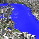
AAM’s 3D Flood Simulation of Brisbane was used extensively by Australian and Global media during the recent flood crisis in Brisbane. The flood level simulations were produced interactively in 3D. This was a very effective way of communicating...

Tuesday, January 18th, 2011

Topcon Announces RTP-300 for High-speed Surface Profiling

Topcon Positioning Systems (TPS) new RTP-300 Real Time Profiler collects surface data at speeds up to 65 miles per hour (105 km/hr) and creates an exact model of the existing surface.

Tuesday, January 18th, 2011

Topcon Five-year Guarantee for Laser Products

Topcon Positioning Systems (TPS) has announced an industry-leading five-year guarantee for all Topcon manufactured laser products.

Monday, January 17th, 2011

LPS 2011 Now Available

LPS is a powerful, workflow-oriented photogrammetry system for production mapping, including full analytical triangulation, the generation of digital terrain models, orthophoto production, mosaicking, and 3D feature extraction.

Monday, January 17th, 2011

Registration Opens for Esri Technical Certification Examinations

Starting today, Esri software users can sign up to take the Esri Technical Certification Program examinations. The program recognizes people skilled in desktop, developer, and enterprise use of Esri technology. Certifications are currently being offered for:
Monday, January 17th, 2011

Trimble Introduces New Field Layout Software Suite

Trimble introduced its new field layout software suite that includes Trimble® Field Link for MEP and Trimble Field Link for Structures. The latest additions to Trimble?s field layout portfolio incorporate a version for MEP trades and a...

Wednesday, January 12th, 2011

Leica Geosystems Launch Terrestrial GPS Augmentation Network

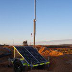
Mining fleet management specialists Leica Geosystems have launched their GPS Augmentation Network, incorporating exclusive technology developed by Locata Corporation.

Tuesday, January 11th, 2011

Intergraph Releases New Version of Enterprise Viewing and Markup Software

Intergraph has released the newest version of its enterprise viewing and markup software solution, SmartPlant Markup Plus.  SmartPlant Markup Plus enables efficient and cost-effective precision view, markup and related capabilities for the many different types of engineering...
Tuesday, January 11th, 2011

SMAP Digital Map Management System

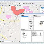
SMAP Technologies Inc. is an electronic map supplier, providing navigation system, LBS, Internet Map, and GIS projects for applications in various fields. Besides Taiwan, SMAP digital map database also includes Hong Kong, Macao, Singapore, etc.

Page 423 of 427 1 418 419 420 421 422 423 424 425 426 427