Thursday, January 27th, 2011
Scanpoint Geomatics Ltd has announced that IGIS Package Developed by the Company with Technical "Know-how" from ISRO was launched on July 29, 2009 at Bangalore by the Chairman of ISRO. The Upgraded version of the software IGIS...
Thursday, January 27th, 2011
The new Mura MPX Series cards combine traditionally separate input and output cards onto a single-slot, PCI Express x16 Gen 2 board, leveraging 64 Gb/sec full duplex data transfer to display full frame rate, HD video input...

Thursday, January 27th, 2011
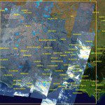
The RapidEye constellation of five earth observation satellites have been focused on the East Coast of Australia, dedicating resources to capture valuable images of the ever- changing face of our flooding landscape. The readily enhanced RapidEye satellite...
Wednesday, January 26th, 2011
Esri announced today that Microsoft has selected ArcGIS as a foundation for viewing geospatial information within the DataMarket in Windows Azure Marketplace. Application developers and end users will be able to select the data they need in...
Wednesday, January 26th, 2011
SuperGIS Server 3 is a set of map server software enabling enterprises to create, manage, integrate, and publish various GIS services in the centralized server architecture. For users who are in field survey, they can apply SuperPad...

Tuesday, January 25th, 2011
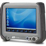
Tablet innovator DAP Technologies today announced the availability of two new Windows CE 6.0-based rugged tablet computers. The voice-ready M8930 and M8940 models are the first tablets to incorporate breakthrough display technology that delivers maximum viewability in...

Tuesday, January 25th, 2011
Juniper Systems is proud to announce that the Mesa Geo 3G Rugged Notepad is now available for shipment. In addition to all of the features available on the Mesa Geo model (Bluetooth® wireless technology, Wi-Fi®, GPS, and...

Saturday, January 22nd, 2011
Pointools has launched a new high-value software bundle for working with point clouds – the billions of measurement points collected by 3D laser scanners. This new “Pointools Suite” gives users a portfolio of applications and plugs-ins designed...
Saturday, January 22nd, 2011
This site hosts OCM data products (Radiance, Geo-physical Parameter , Binned ) and Scatterometer data products. Users can browse and download data products. OCM GAC data products are available from 05-JAN-2010 onwards in the form of strips...