Products
Tuesday, October 11th, 2011
AVEVA has released AVEVA Engineering, a new product where the full definition of tagged engineering items (equipment, lines etc.) can be developed by multi-disciplinary teams of specialist engineers...
Sunday, October 9th, 2011
It maps out New Zealand's resources within the EEZ, highlights climate change related issues, and shows how plants and animals in the area may respond to future changes facing New Zealand's waters. This version of the atlas...
Friday, October 7th, 2011
The Capricorn deep crustal seismic survey was acquired in 2010 and extends almost 600km from the Pilbara Craton, across the Hammersley Basin and the Capricorn Orogen, to the Yilgran Craton in Western Australia. This survey was a...

Thursday, October 6th, 2011
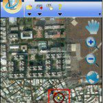
SuperGeo Technologies, the leading global provider of complete GIS software and solutions, today announced that its latest fully functional mobile GIS software, SuperPad 3.0a, is officially launched to global market. SuperPad 3 consists of...

Tuesday, October 4th, 2011
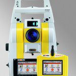
GeoMax expands its existing total station portfolio with the Zoom80 Total Station, available as robotic or servo model, to be used easily as a one man total station with up to 1000 meters reflectorless range.

Tuesday, October 4th, 2011
A new member of GeoMax’s complete and...
Saturday, October 1st, 2011
ERDAS proudly announces the release of ECW for ArcGIS Server, version 11.0.2. This product provides a means for ArcGIS Server to deliver data in the ERDAS-patented Enhanced Compression Wavelet (ECW) format to clients via OGC-compliant Web Coverage...
Friday, September 30th, 2011
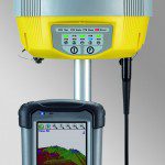
Leica Geosystems announces the new xRTK and SmartRTK for Leica Viva GNSS. Leica xRTK is a new RTK solution that provides maximum availability even in the most difficult conditions. Leica SmartRTK delivers reliable, consistent results in all RTK Networks and...
Thursday, September 29th, 2011
Holistic City Software has released CityCAD 2.2 with a new data import engine and improved 2d drawings, as well as several new features and further improvements in stability and performance. The new data import feature is a key...
Wednesday, September 28th, 2011
The Leica GR25 GNSS Reference Server is more than just a reference receiver. With integrated internal and external device management, multi-user management, high end security, modular and scalable design, the GR25 GNSS Reference Server will grow with...
