
Tuesday, October 4th, 2011
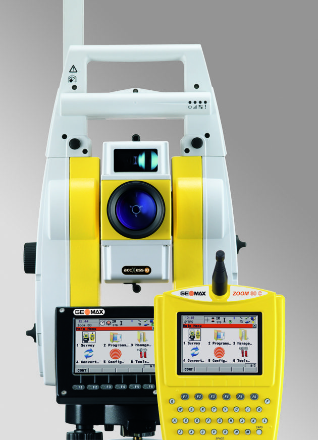
GeoMax expands its existing total station portfolio with the Zoom80 Total Station, available as robotic or servo model, to be used easily as a one man total station with up to 1000 meters reflectorless range.

Tuesday, October 4th, 2011
Saturday, October 1st, 2011
ERDAS proudly announces the release of ECW for ArcGIS Server, version 11.0.2. This product provides a means for ArcGIS Server to deliver data in the ERDAS-patented Enhanced Compression Wavelet (ECW) format to clients via OGC-compliant Web Coverage...
Friday, September 30th, 2011
Leica Geosystems announces the new xRTK and SmartRTK for Leica Viva GNSS. Leica xRTK is a new RTK solution that provides maximum availability even in the most difficult conditions. Leica SmartRTK delivers reliable, consistent results in all RTK Networks and...
Thursday, September 29th, 2011
Holistic City Software has released CityCAD 2.2 with a new data import engine and improved 2d drawings, as well as several new features and further improvements in stability and performance. The new data import feature is a key...
Wednesday, September 28th, 2011
The Leica GR25 GNSS Reference Server is more than just a reference receiver. With integrated internal and external device management, multi-user management, high end security, modular and scalable design, the GR25 GNSS Reference Server will grow with...
Wednesday, September 28th, 2011
Optech Incorporated, the world’s leading manufacturer of advanced lidar and camera survey instruments, is pleased to announce a new lightweight, state-of-the-art mounting platform for its Lynx Mobile Mapper. The newly designed rack features rigid mounting points and...
Wednesday, September 28th, 2011
A South African company is pioneering the latest laser scanning technology with plans to mount high speed scanners on a variety of mobile platforms including a gyrocopter, 4x4’s and even a golf cart. Supplied by 3D Laser...
Wednesday, September 28th, 2011
Trimble introduced today a new version of its terrestrial mobile mapping office software—Trimble Trident Analyst 4.7. The software is designed to effectively manage and interpret high-resolution digital images and large point clouds, and automatically extract features from...
Wednesday, September 28th, 2011
SuperGeo Technologies announced a new sales achievement in Indonesia. The Directorate General of Highways (Bina Marga) at the Ministry of Public Works selected SuperGIS Desktop 3 and SuperPad 3 to enhance traffic development and transportation management in...
