Wednesday, October 9th, 2019
Toulouse – Airbus has unveiled the names of the three finalists for the “Airbus - Sobloo Multi-Data Challenge” organised as part of the Copernicus Masters 2019. This international competition awards pioneering solutions, concepts and ideas for industry...
Wednesday, October 9th, 2019
(Heerbrugg, Switzerland, 9 October 2019) - Leica Geosystems, part of Hexagon, announced today a new software upgrade for Leica iCON field software as the first development under the collaboration with Procore, a leading provider of construction management software. The...

Tuesday, October 8th, 2019
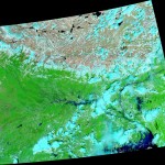
India’s 2019 monsoon season has been one of the most unusual in recent decades. From June to September 2019, India received the highest amount of monsoonal rain in 25 years of records. According to the India Meteorological...
Tuesday, October 8th, 2019
Amsterdam and Seoul – HERE Technologies, a global leader in mapping and location platform services, and HYUNDAI MNSOFT, a Hyundai Motor Group subsidiary specializing in mapping technology responsible for the Hyundai KIA Motors infotainment system, today announced...
Tuesday, October 8th, 2019
SAN JOSE, Calif.- Dr. Mircea Gradu, Sr. Vice President Quality and Validation at Velodyne Lidar, Inc., will be featured on two panels at the upcoming GITEX Technology Week in Dubai on October 7 and 8. Gradu, a...
Tuesday, October 8th, 2019
WESTMINSTER, Colo.- Maxar Technologies (NYSE:MAXR) (TSX:MAXR), a trusted partner and innovator in Earth Intelligence and Space Infrastructure, today announced that it has been awarded a $14.2 million contract to develop Red Wing, an automated, cloud-based geospatial intelligence...
Tuesday, October 8th, 2019
WASHINGTON, Oct. 7, 2019 /PRNewswire/ -- The KIC-FedTech Accelerator Pitch Day, held on 10/3/2019, is the final phase of the accelerator program in which the startups put their newly acquired skills and knowledge to the test by pitching...
Tuesday, October 8th, 2019
SAN DIEGO – 07 October 2019 – General Atomics Aeronautical Systems, Inc. (GA-ASI) has signed a cooperative agreement with NASA to perform a demonstration flight as part of the agency’s project to integrate Unmanned Aircraft Systems (UAS)...
Tuesday, October 8th, 2019
GOLDEN, Colorado – Golden Software, a developer of affordable 2D and 3D scientific modeling packages, today announced that its six software products are now available on GeoCloud, a cloud-based software-as-a-service platform hosting geospatial, mapping, and geoscience applications....
Monday, October 7th, 2019
— The American Geographical Society (AGS) has awarded seven EthicalGEO Fellowships as a result of the Society’s EthicalGEO Video Challenge. The Challenge, in its first year and underwritten by Omidyar Network, solicited videos...