Thursday, April 2nd, 2020
RFI will feed into a study to help modernize spatial data infrastructures by integrating new tools, standards, and techniques (such as machine learning) to advance inter-jurisdictional data interoperability The Open Geospatial Consortium (OGC) and Natural Resources Canada...
Thursday, April 2nd, 2020
NACKA STRAND, Sweden - Hexagon AB's Nomination Committee proposes the election of Patrick Söderlund as a new member of Hexagon's Board of Directors at the Annual General Meeting (AGM) 2020. Furthermore, the Nomination Committee proposes the re-election...
Wednesday, April 1st, 2020
Highlights daily "micro-challenges" for individuals to take to fight climate change in the face of the coronavirus pandemic WASHINGTON, DC, (April 1, 2020) — To count down to the 50th anniversary of Earth Day, Earth Day...
Wednesday, April 1st, 2020
Leica Geosystems, a Hexagon company, announced today a new 3D laser scanning bundle for the BLK360 and greater integration with Autodesk ecosystem. HEERBRUGG, Switzerland – Leica Geosystems, a Hexagon company, announced today a new 3D laser...
Wednesday, April 1st, 2020
COLORADO SPRINGS, Colo. (April 1, 2020) — The Space Foundation’s team of educators has created a new webinar series now available free online to help teachers and parents keep students engaged in learning while at home. The webinars...
Wednesday, April 1st, 2020
San Francisco, CA — Taskade, a Y-Combinator backed startup, launches a real-time organization and collaboration platform for distributed teams. This week, it announced it will be offering a 6-month free upgrade to its Pro version to support...
Wednesday, April 1st, 2020
Indoor location platform provides municipalities with emergency response and public safety solutions on existing WiFi networks TORONTO (ON) MARCH - InnerSpace, the world’s most accurate WiFi-based indoor location intelligence platform, today announced its product capabilities to support...
Wednesday, April 1st, 2020
AARSCHOT, Belgium – Virtual Surveyor has introduced a new feature in Version 7.2 of its popular drone surveying software that automatically highlights terrain slopes that exceed dangerous steepness thresholds. Called Slope Threshold lens, this capability significantly enhances...
Wednesday, April 1st, 2020
CALGARY, AB – SOLV3D, a leading provider of 3D processing, geospatial data visualization and collaboration solutions, is pleased to announce the immediate availability of version 2.2.1.1937 of SOLV3D encompass™ (Encompass) and version 3.0.2 of SOLV3D engine™ (Engine). ...

Tuesday, March 31st, 2020
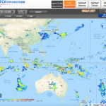
Global Satellite Mapping of Precipitation (GSMaP) has been developed by using multi-satellite products. The rainfall map is provided in real time and visualized every 30 minutes on the JAXA Realtime Rainfall Watch website. Please have a look...