Wednesday, April 11th, 2018
WASHINGTON, D.C.: TerraGo was presented with a Smart 50 Award at Smart Cities Connect, an event which convened leading technology companies with city leaders from around the world in Kansas City. TerraGo was recognized with Ameresco for...
Wednesday, April 11th, 2018
Veurey-Voroize, near Grenoble, France – ULIS, a designer and manufacturer of the widest range of thermal image sensors for commercial, defense and security applications, today announces it has achieved unmatched performance with its bolometer (a type of...

Monday, April 9th, 2018
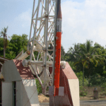
The 21st flight of ISRO’s RH300 Mk-II Sounding Rocket was launched on April 6, 2018, from the Thumba Equatorial Rocket Launching Station (TERLS), VSSC, Thiruvananthapuram. In this launch, the single-stage indigenous Sounding Rocket successfully expelled the chemical...
Monday, April 9th, 2018
CHATTANOOGA, TN – Skytec LLC, a leading Unmanned Aircraft Systems (UAS) and Drone as a Service (DaaS) provider, has been selected to join the Esri Startup program as an emerging business partner. The three-year program is...
Monday, April 9th, 2018
SOUTH JORDAN, Utah- Nearmap, a location content provider, has partnered with the fast-growing city of Carmel, Indiana, helping it improve its stormwater billing process, resulting in the collection of about $60,000 in unclaimed revenue. Carmel turned to...
Monday, April 9th, 2018
Cambridge, UK (www.1spatial.com) 1Spatial, the global geospatial software and solutions company, is pleased to announce that they have been awarded a contract from the European Union Satellite Centre (SatCen) in Torrejón de Ardoz (Madrid, Spain) to provide...
Monday, April 9th, 2018
The proposed national space programme of Ukraine for 2018-2022, and prepared by the State Space Agency of Ukraine (SSAU), could be submitted to the government for consideration in April 2018, according to a source in the Ukrainian...
Monday, April 9th, 2018
Indian Scientists have developed a remote sensing technique that uses satellite data to delineate between various coastal landforms like beaches, mangroves and marshes. This method can help monitor and understand the impact of natural disasters as well...
Monday, April 9th, 2018
Hallowell, Maine - Blue Marble Geographics (bluemarblegeo.com) is pleased to announce the availability of an update to the Global Mapper Academic Curriculum. Comprised of a series of hands-on lessons, the full package of lab materials is available...
Monday, April 9th, 2018
One area that’s booming? Geospatial analytics, an industry where satellites are used to track everything from retail footfall to food production. Companies working on the technology have attracted big money. Orbital Insight raised $50 million in funding...