Thursday, December 19th, 2019
ATLANTA - Skyfire Consulting - the country's leading public safety drone consultancy - is teaming up with Skydas Group - which specializes in law enforcement and counter-terrorism training - to create the SkyTac Training Academy for POST-certified...
Thursday, December 19th, 2019
PHOENIX - AerialSphere, an innovative tech startup creating immersive and interactive 360-degree maps, is offering real estate agents the opportunity to add what some consumers are calling an "addictive" online experience to their websites. Partnering with iFoundAgent,...
Thursday, December 19th, 2019
Simulyze, Inc., a leading provider of operational intelligence (OI) technology and applications that empower both federal and commercial organizations, today announced it has been named to the 2019 NVTC Tech 100 list by the Northern Virginia Technology...
Thursday, December 19th, 2019
CHICAGO - Rand McNally today launched the TND™ Tablet 85, an all-new dashboard tablet fueled by powerful new navigation software built for professional drivers. The tablet marks the company's 6th generation of truck navigation devices – and...
Thursday, December 19th, 2019
VIRGINIA BEACH, Va. - DroneUp, LLC signed a Participating Addendum with the State of Connecticut established as the Procurement Division Contract #19PSX0049. This begins the offering for the purchase of complete drone solutions to all state agencies,...
Thursday, December 19th, 2019
Pluxity, a plug-in solution provider based in Korea, announced on December 16, 2019 the launch of the PLUG Kiosk that provides 3D-based spatial information. The PLUG Kiosk helps one easily find important facilities and stores by displaying...
Thursday, December 19th, 2019
REHOVOT, Israel - Cognata, Ltd., a leading provider of simulation software for ADAS and autonomous vehicles announced today that Innoviz, a leading provider of high-performance solid-state LiDAR sensors and perception software that bring vision to the automotive and...
Tuesday, December 17th, 2019
DAYTON, Ohio (Dec. 17, 2019) — Woolpert has been selected to perform aerial mapping and surveying via manned aircraft and unmanned aircraft systems (UAS) for two global mining operations under two separate contracts. The imagery is being...

Monday, December 16th, 2019
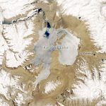
Karakul in many Turkish languages means “black lake.” That description of Karakul Lake, located high in the eastern Pamir Mountains in Tajikistan, is accurate for some of the year. But during the region’s frigid winter, the dark...
Monday, December 16th, 2019
Massachusetts – Aerial mapping company Bluesky International has launched a new 3D data capture programme in the US. The MetroVista product suite sees high resolution imagery, both vertical and oblique, captured simultaneously with high accuracy, wide scale...