
Tuesday, March 28th, 2017
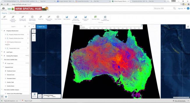
Advances in spatial technology that enable digital agriculture, including a next-generation national positioning system and real-time monitoring of soil moisture levels from space, will take center stage in April 2017 at the International Symposium on Digital Earth...
Tuesday, March 28th, 2017
CARMEL, Indiana – PrecisionPoint Inc., a national provider of 3D reality capture laser scanning and SCAN-to-BIM Modeling solutions, is pleased to announce the hiring of Will Hirschfeld, an experienced Unmanned Aerial System (sUAS) pilot. Hirschfeld will assist...
Tuesday, March 28th, 2017
Aerial mapping company Bluesky has launched a new online Mapshop to serve the rapidly expanding mapping and geographic information industry in Ireland. With tens of thousands of square kilometres of new data available to view and download,...
Tuesday, March 28th, 2017
Portland, Maine, USA – Commercial UAV Expo today announced the release of a free series of reports that showcase how and where professionals charged with the inspection and monitoring of industrial assets such as electricity pylons, pipelines, and...
Monday, March 27th, 2017
Researchers from the Chinese Academy of Sciences (CAS) recently used remote-sensing equipment in their efforts to restore a vanished section of the Great Wall in Northwest China's Xinjiang Uyghur Autonomous Region. Read More at CAS
Monday, March 27th, 2017
Philadelphia is in the process of ramping up its smart applications thanks to a grant from the Smart Cities Council and plans to bring in a consultant to help it pave the way for a detailed roadmap...
Monday, March 27th, 2017
South Korea is planning to train 1,700 drone operators a year to meet growing demand in the commercial drone industry, the transport ministry said Tuesday. Read More at UAS Weekly
Monday, March 27th, 2017
Kuala Lumpur: Geospatial Media and Communications is pleased to announce that the nominations for Asia Geospatial Excellence Awards are now open. As geospatial information and technology is becoming a critical tool in nation building and decision-making, governments...
Monday, March 27th, 2017
Geospatial information forms a critical part of many IoT solutions, and Australia is at the forefront of driving improvements to its accuracy, according to one executive. Read More at IOTHub
Monday, March 27th, 2017
VADODARA: The Vadodara Municipal Corporation (VMC) will be conducting a Geographical Information System (GIS) based survey of properties in the city. The civic body will be deploying technique for the first time. Read More at Times of...