Wednesday, January 4th, 2012
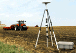
Vineyards vary substantially in the quantity and quality of grapes they produce. Yield and various measures of quality are known to vary widely within blocks and along rows. Two consequences of this are the uncertainty in the...
Wednesday, January 4th, 2012
NovAtel Connect is a windows-based GUI that provides easy access your receiver’s many features without the need to use a terminal emulator or to write special software. NovAtel Connect lets you communicate and configure your receiver via...
Wednesday, January 4th, 2012
The Department of Environment and Natural Resources’ (DENR) Philippines’ Land Administration and Management Project Phase 2 (LAMP2) was featured during the 2011 Global South-South Development (GSSD) Expo held Dec. 5 at its headquarters in Rome, Italy. DENR Secretary...

Wednesday, January 4th, 2012
Higher commodity prices are resulting in higher bottom lines for many agricultural producers today. Productive agricultural land is no longer readily available, and a growing global population increasingly depends upon technological innovation to meet consumer needs. As...
Monday, January 2nd, 2012
As shown earlier the data contributions to OSM show a geographically heterogeneous pattern around the globe. Germany counts as one of the most active countries in OSM; thus, the German street network has undergone an extensive development...
Monday, January 2nd, 2012
Until not too long ago, Government of India and the sugar industry manually estimated the area under sugarcane cultivation. This system involved the collection of estimates from the field and the compilation of data. That system had...
Sunday, January 1st, 2012
President Benigno Aquino III has ordered the release of P1.6 billion to the Department of Science and Technology (DOST) to enable it to tap “state-of-the-art technology” and improve the accuracy of weather and disaster information-gathering and reporting...
Sunday, January 1st, 2012
Geo Tactical Solutions (GTS) is in the final stages of development for its new photo mapping and management software—PhotoGIS. PhotoGIS, planned to be released in early first quarter 2012, will allow users to easily map, organize, export...