Asian Surveying & Mapping
Breaking News
NASA releases satellite photos of Dubai and Abu Dhabi before and after record flooding
NASA released photos of parts of Dubai and Abu...
Singapore releases 10-year Geospatial Master Plan
Singapore has launched its new Geospatial Master Plan (2024–33),...
Japan announces plans to launch upgraded observation satellites on new flagship rocket’s 3rd flight
TOKYO (AP) — Japan’s space agency announced Friday a...
Tesla China partners with Baidu for maps to clear FSD hurdle
Amidst Elon Musk’s unannounced trip to Beijing, China this...
ESA opens ideas factory to boost space innovation in Austria
A centre to innovate the design and manufacture of...
Japan’s space agency sets June 30 as third launch date for H3 rocket
The Japan Aerospace Exploration Agency (JAXA) announced Friday that...
S. Korea launches nanosatellite for Earth observation
SEOUL- A South Korean nanosatellite was launched into orbit...
Australian Space Agency funds development of aerospace-grade GNSS receiver
The Australian Space Agency has funded the development of...
Continuity risks for Australian EO data access
A new report details the widespread use of Earth...
China launches new remote sensing satellite
JIUQUAN, April 15 (Xinhua) -- China on Monday launched...
n57132244IMG_1

According to the government of Japan the International Charter “Space and Major Disasters” started to operate. Since morning March 12 world satellite Operators conduct optical imagery of the damaged areas in Japan.

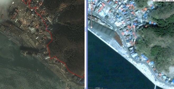
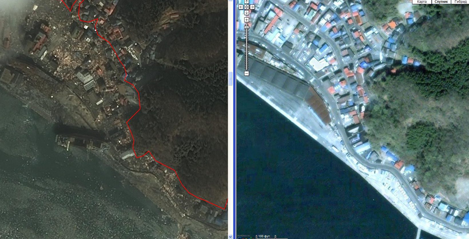
Images from IKONOS satellite were acquired by the request from ScanEx RDC and submitted on-line to the EMERCOM of Russia. Analysis of the Tokyo districts did not reveal major destructions, which testifies to high seismic resistance of buildings. However, eastern coastline of the country suffered much more damage.

The area of the disaster in Japan. Left: IKONOS image, acquired on 12.03.11 (GEOEYE, SCANEX). Right: image prior to the disaster. Google Earth data 

Read More