Monday, October 3rd, 2016
The first images from the PeruSAT-1 Earth observation satellite have been received at the CNOIS satellite operations center in Lima, the defense ministry said Friday. Read More at Fox News Latino
Monday, June 27th, 2016
Pimpri Chinchwad: The civic body has decided to obtain Google images from National Remote Sensing Centre, Hyderabad, to identify illegal constructions cropping up after January 1, 2016, within its limits. Read More at Times of India
Monday, December 14th, 2015
Soon after the recent rains hit hard the costal districts, Tamil Nadu Agricultural University (TNAU), Coimbatore, calculated how much cultivated area was inundated. It also estimated the loss of paddy in Tiruvallur, Kancheepuram, Cuddalore and other districts....
Saturday, November 19th, 2011
The plan drawn up by Australia and Indonesia - which hosts the East Asia Summit beginning in Bali today - would involve countries including China and the US instantly sharing sensitive satellite images, damage and casualty reports...
Thursday, November 10th, 2011
Tuesday, July 12th, 2011
Satellites can bring new transparency to how forests are being managed. With the increasing production of pulp, paper and timber products, there is concern over the effect that expanding plantations and logging in natural forests have on...
Monday, May 16th, 2011
A comprehensive study of Isro satellite images reveals 75% of Himalayan glaciers are on the retreat, with the average shrinkage being 3.75km during the 15 years under study. The grim findings come after raging controversy over claims...
Tuesday, April 26th, 2011
The three cameras on board Resourcesat-2 will be switched on when the satellite passes over 3,000 km of the Indian landmass from Joshimutt in Uttarakhand to Kannur in Kerala on April 28 and they will transmit pictures...
Thursday, March 31st, 2011
Starting from March 2011 the testing of the service of operational space information support of ice operations in the White Sea has been ongoing in behalf of the Arkhangelsk Branch of the FSUE “Rosmorport”. As part of the...

Wednesday, March 16th, 2011
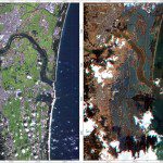
The images were acquired by the German Optical RapidEye and radar TerraSAR-X satellites. They show Torinoumi on the eastern coast of Japan before the disaster on 5 September 2010 and after the tsunami on 12 March 2011....