Asian Surveying & Mapping
Breaking News
Thailand to launch its second Earth satellite next week
Thailand is set to launch it second Earth observation...
Chinese launch startup’s rocket fails during satellite launch
The Chinese launch company Galactic Energy suffered its first...
First Hong Kong-made satellite set to launch in November from Guangdong province, company reveals
The first Hong Kong-made satellite is set to be...
China launches Yaogan 39 remote sensing satellite
China launched a Long March 2D carrier rocket on...
Saudi Arabia publishes maps with new names for ceded islands
A new map published by Saudi Arabia’s General Authority...
US, Saudi Arabia conclude region’s largest-ever counter-UAS exercise
The US and Saudi Arabia conducted the largest-ever counter-UAS exercise...
Study improves accuracy of planted forest locations in East Asia
An international team led by Purdue University scientists has...
Iran, Russia Working On Joint Research Spacecraft
In an interview with Tasnim, the president of the...
France, Bangladesh sign deal to provide loans, satellite technology during Macron’s visit to Dhaka
French President Emmanuel Macron witnessed the signature of a...
Iran, Russia Working on Joint Research Spacecraft
TEHRAN (Tasnim) – Top universities from Iran and Russia...

geoeye

Tuesday, January 17th, 2012

GeoEye Selects Cleversafe for Satellite Imagery Active Archive

GeoEye has selected Cleversafe, Inc., to meet its requirements for a highly reliable and secure active archive  to support their business mission and to maintain their image archive.
Sunday, March 13th, 2011

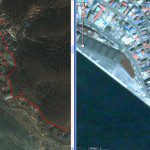
Earthquake in Japan: Detailed Satellite Images Received

Detailed satellite images of the territory of Japan were received, where a series of earthquakes were registered on March 11 in its north-eastern parts. According to the Main Meteorological Service of the country the 8.9 magnitude earthquake...

Tuesday, March 8th, 2011

Libya: Satellite Images Show Refugee Crisis

Satellite pictures showing the extent of Libya’s refugee problem have emerged. The GeoEye-1images reveal a mass of people at the Ras Ajdir crossing at Libya’s border with Tunisia. But they only indicate scale, not detail. The satellite pictures taken on...

Thursday, December 18th, 2008

GeoEye Finalises NGA Contract

The Pentagon's National Geospatial-Intelligence Agency has given GeoEye, Inc a contract valued at US$12.5 million per month for the next year. Under the agreement, GeoEye will supply satellite imagery products to the NGA as soon as its...