
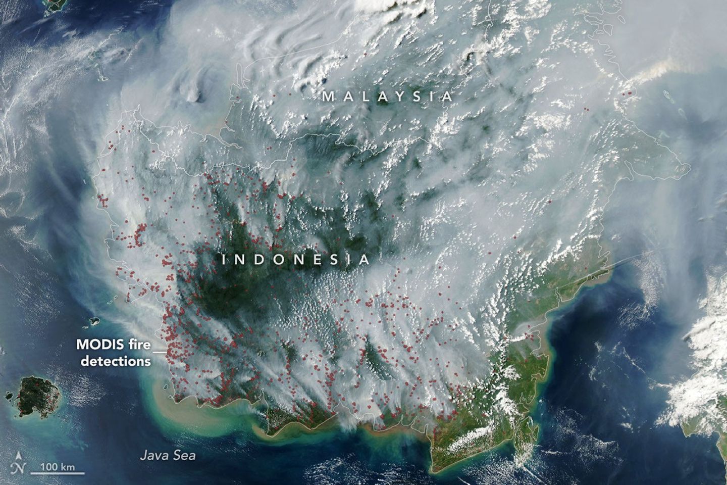
Smoke from widespread fires blanketed parts of Indonesia in early September 2026 as drought created conditions for fires to spread through the country’s peatlands.
NASA’s Aqua satellite captured extensive smoke over Borneo on Sept. 1, 2026, with its MODIS instrument. Satellite fire detections in red reveal numerous thermal anomalies across the southern portion of the island. Indonesia’s fire-monitoring system recorded 946 hotspots on Aug. 31.
Peat fires are particularly difficult to control because they can smolder underground in dried wetland soils. Indonesia was experiencing widespread drought during summer 2026, while El Niño conditions were strengthening and contributing to reduced rainfall.
MODIS and VIIRS observations are used by Indonesian authorities to track active fires, although thick smoke, clouds and underground burning can make some fires difficult for the satellite instruments to detect. Researchers are also investigating Landsat and Sentinel-2 observations as a way to improve detection of understory fires.
Image Credit: NASA Earth Observatory/Lauren Dauphin, using MODIS data from NASA EOSDIS LANCE and GIBS/Worldview
