
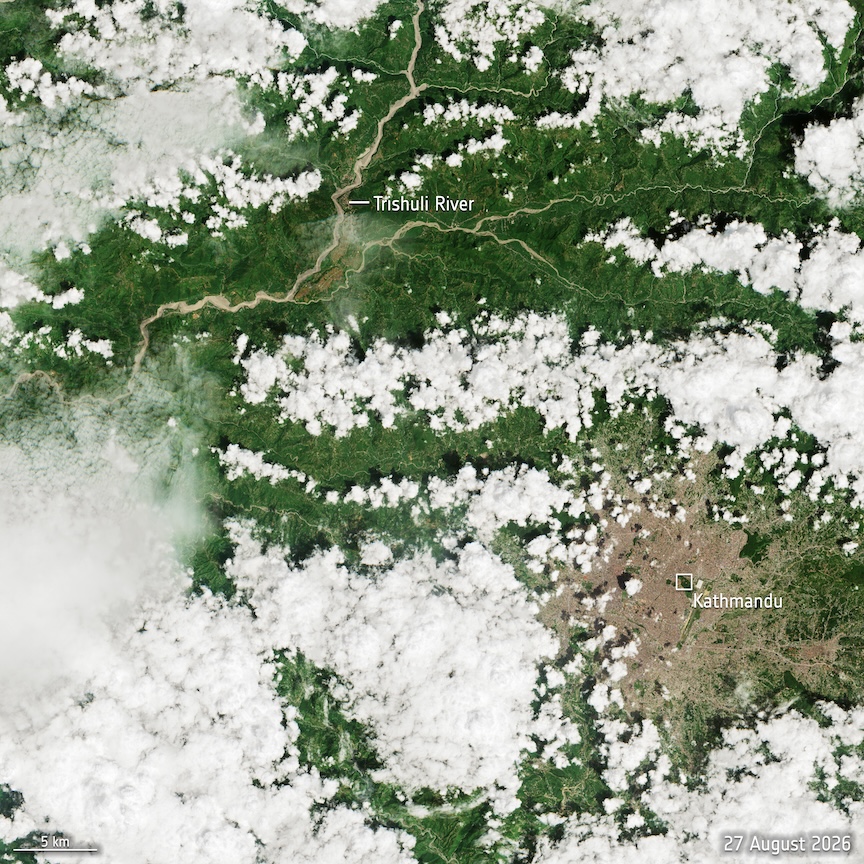
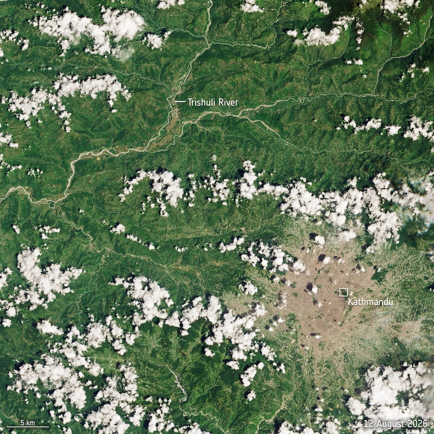
 Satellite imagery captured the aftermath of a catastrophic flash flood that swept through northern Nepal on Aug. 26, 2026.
The event began with a rapid slope failure associated with a glacier collapse on Langtang Lirung in Langtang National Park. Water, ice and debris then traveled downstream through the region, damaging communities and infrastructure along river valleys near the Nepal-China border.
Copernicus Sentinel-2 imagery acquired the following day (above) shows the dramatic increase in river levels compared with imagery collected before the flood. Landsat 9 also observed the area about two hours after the glacier collapse, providing another view of the rapidly developing disaster. The image to the left was acquired on Aug. 12, 2026, prior to the flood.
The International Charter Space and Major Disasters and Copernicus Emergency Mapping Service were activated to provide satellite information for the response. The imagery can also support assessments of damaged roads, bridges and buildings as recovery efforts continue.
Credit: Contains modified Copernicus Sentinel data (2026), processed by ESA
