
Asian Surveying & Mapping
Breaking News
ISRO Maps Over 2,000 Glaciers, 3,219 Glacial Lakes in Ladakh for Disaster Management
SRINAGAR: The Indian Space Research Organisation (ISRO) and other...
China Closes the Satellite Gap in Space Race With the U.S.
China aims to match the U.S. as the world’s...
IIT-Tirupati hosts fifth BRICS working group meeting on geospatial technologies
The Indian Institute of Technology-Tirupati (IIT-Tirupati), in collaboration with...
South Korea launches 4th Earth observation satellite from US
South Korea on Tuesday launched its fourth Earth observation...
Korea AeroSpace Administration Unveils K-Space Vision
Agency Will Benchmark European Aerospace Clusters and Explore Joint...
Japan space agency conducts Epsilon rocket engine test after failures
TOKYO - The Japan Aerospace Exploration Agency on Thursday...
UAE to boldly go with programme to boost nation’s expertise in space sector
A programme has been announced to enhance Emirati expertise...
China is building a ‘Mach 26 asteroid hammer’ to strike space rocks before they hit Earth
The Earth revolves in a cosmic system which is...
Nigeria and Benin Strengthen Border Surveillance with Geospatial Technology
The partnership was highlighted during a strategic meeting at...
IIT-Tirupati hosts fifth BRICS working group meeting on geospatial technologies
The Indian Institute of Technology-Tirupati (IIT-Tirupati), in collaboration with...
  • May 19, 2026
  • Comments Off on NASA Analysis Shows Irreversible Sea Level Rise for Pacific Islands 
  • Feature
  • 411 Views

May 19th, 2026
NASA Analysis Shows Irreversible Sea Level Rise for Pacific Islands 

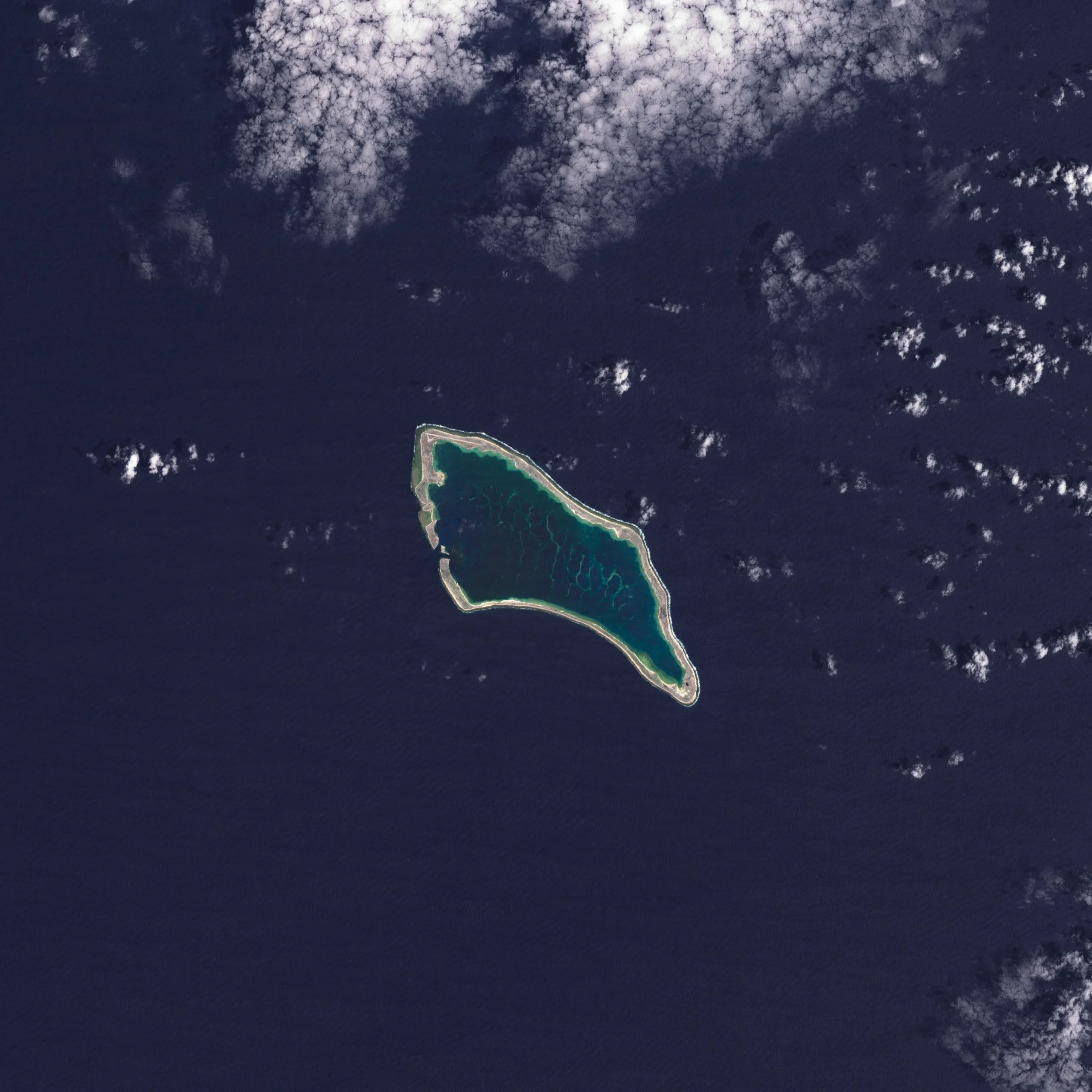
In the next 30 years, Pacific Island nations such as Tuvalu, Kiribati (pictured) and Fiji will experience at least 6 inches (15 centimeters) of sea-level rise, according to an analysis by NASA’s sea-level change science team. This amount of rise will occur regardless of whether greenhouse gas emissions change in the coming years. 

The sea level change team undertook the analysis of this region at the request of several Pacific Island nations, including Tuvalu and Kiribati, and in close coordination with the U.S. Department of State. 

In addition to the overall analysis, the agency’s sea-level team produced high-resolution maps showing which areas of different Pacific Island nations will be vulnerable to high-tide flooding—otherwise known as nuisance flooding or sunny day flooding—by the 2050s. Released on Sept. 23, 2025, the maps outline flooding potential in a range of emissions scenarios, from best-case to business-as-usual to worst-case. 

Image Credit: NASA Earth Observatory