Asian Surveying & Mapping
Breaking News
Ecolab and ITE partners to harness water management knowledge for Singapore data center engineers
SINGAPORE, 29 APRIL 2024 – Nalco Water, an Ecolab...
NASA releases satellite photos of Dubai and Abu Dhabi before and after record flooding
NASA released photos of parts of Dubai and Abu...
Singapore releases 10-year Geospatial Master Plan
Singapore has launched its new Geospatial Master Plan (2024–33),...
Japan announces plans to launch upgraded observation satellites on new flagship rocket’s 3rd flight
TOKYO (AP) — Japan’s space agency announced Friday a...
Tesla China partners with Baidu for maps to clear FSD hurdle
Amidst Elon Musk’s unannounced trip to Beijing, China this...
ESA opens ideas factory to boost space innovation in Austria
A centre to innovate the design and manufacture of...
Japan’s space agency sets June 30 as third launch date for H3 rocket
The Japan Aerospace Exploration Agency (JAXA) announced Friday that...
S. Korea launches nanosatellite for Earth observation
SEOUL- A South Korean nanosatellite was launched into orbit...
Australian Space Agency funds development of aerospace-grade GNSS receiver
The Australian Space Agency has funded the development of...
Continuity risks for Australian EO data access
A new report details the widespread use of Earth...

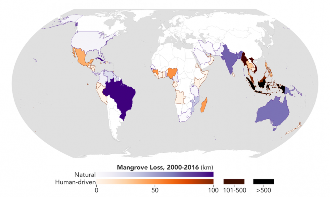
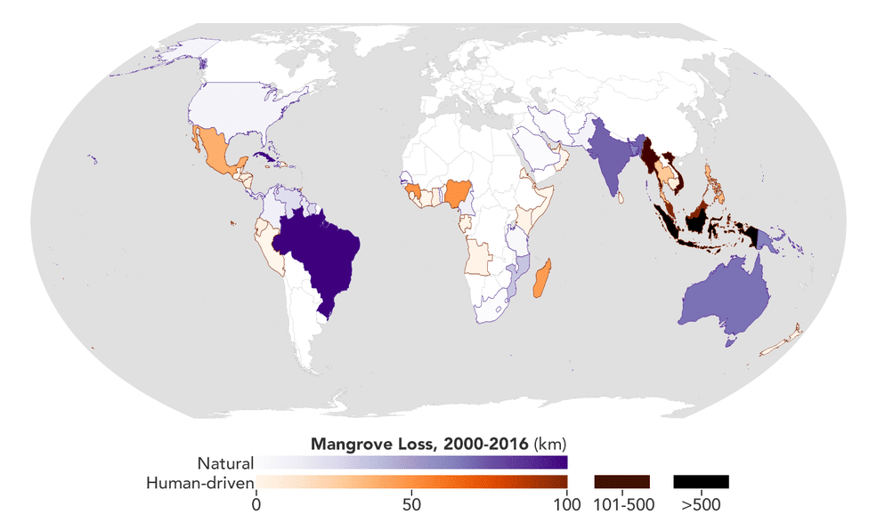
Using high-resolution data from the joint NASA-U.S. Geological Survey Landsat program, researchers have created the first map of the causes of change in global mangrove habitats between 2000 and 2016—a valuable tool to aid conservation efforts for these vital coastline defenders.

Mangroves are hardy trees and shrubs that grow in the salty, wet, muddy soils of Earth’s tropical and subtropical coastlines. They protect the coastlines from erosion and storm damage; store carbon within their roots, trunks, and in the soil; and provide habitats for commercially important marine species. The study showed that overall, mangrove habitat loss declined during the period. However, losses from natural causes like erosion and extreme weather declined more slowly than human causes such as farming and aquaculture. For conservation and resource managers trying to prevent loss or re-establish new habitats, this finding highlights the need for strategies that account for natural causes of loss.

The global map will benefit researchers investigating the carbon cycle impacts of mangrove gain and loss, as well as help conservation organizations identify where to protect or restore these vital coastal habitats.

Image Credit: NASA Earth Observatory/Joshua Stevens